From Wikipedia, the free encyclopedia
his article is about the canyon in the southwestern United States. For other Grand Canyons, see Grand Canyon (disambiguation).
Grand Canyon
View of the Colorado River flowing through the Grand Canyon from Hermit's Rest.
Grand Canyon is located in Arizona
Grand Canyon
Arizona, United States
Floor elevation approx. 2,600 feet (800 m)
Long-axis length 277 miles (446 km)
Width 4 to 18 miles (6.4 to 29 km)
Coordinates 36°06′N 112°06′W / 36.1°N 112.1°W / 36.1; -112.1Coordinates: 36°06′N 112°06′W / 36.1°N 112.1°W / 36.1; -112.1
The Grand Canyon is a steep-sided canyon carved by the Colorado River in the United States in the state of Arizona. It is largely contained within the Grand Canyon National Park, one of the first national parks in the United States. President Theodore Roosevelt was a major proponent of preservation of the Grand Canyon area, and visited it on numerous occasions to hunt and enjoy the scenery.
The Grand Canyon is 277 miles (446 km) long, up to 18 miles (29 km) wide and attains a depth of over a mile (1.83 km) (6000 feet).[1] Nearly two billion years of the Earth's geological history have been exposed as the Colorado River and its tributaries cut their channels through layer after layer of rock while the Colorado Plateau was uplifted.[2] While the specific geologic processes and timing that formed the Grand Canyon are the subject of debate by geologists,[3] recent evidence suggests the Colorado River established its course through the canyon at least 17 million years ago.[4][5] Since that time, the Colorado River continued to erode and form the canyon to the point we see it at today.[6]
Before European immigration, the area was inhabited by Native Americans who built settlements within the canyon and its many caves. The Pueblo people considered the Grand Canyon ("Ongtupqa" in Hopi language) a holy site and made pilgrimages to it.[7] The first European known to have viewed the Grand Canyon was García López de Cárdenas from Spain, who arrived in 1540.[8]
Contents
[hide]
* 1 Geography
* 2 Geology
* 3 Human history
o 3.1 Native Americans
o 3.2 European arrival and settlement
+ 3.2.1 Spanish explorers
+ 3.2.2 American exploration
+ 3.2.3 Settlers in and near the canyon
+ 3.2.4 Federal protection
* 4 South Rim buildings
* 5 Weather
o 5.1 Air pollution
* 6 Biology and ecology
o 6.1 Plants
o 6.2 Animals
o 6.3 Life zones and communities
+ 6.3.1 Lower Sonoran
+ 6.3.2 Upper Sonoran and Transition
+ 6.3.3 Canadian and Hudsonian
* 7 Grand Canyon tourism
o 7.1 Activities
o 7.2 Viewing the canyon
* 8 Grand Canyon fatalities
o 8.1 1956 air disaster
* 9 Evacuation
* 10 See also
* 11 References
* 12 External links
[edit] Geography
Satellite image of the Grand Canyon area
The Grand Canyon is a huge rift in the Colorado Plateau that exposes uplifted Proterozoic and Paleozoic strata, and is also one of the six distinct physiographic sections of the Colorado Plateau province. It is not the deepest canyon in the world (Kali Gandaki Gorge in Nepal is far deeper), nor the widest (Capertee Valley in Australia is about 0.6 mi/1 km wider and longer than Grand Canyon); however, the Grand Canyon is known for its visually overwhelming size and its intricate and colorful landscape. Geologically it is significant because of the thick sequence of ancient rocks that are beautifully preserved and exposed in the walls of the canyon. These rock layers record much of the early geologic history of the North American continent.
A map of the Grand Canyon and surrounding areas, circa 1908.
Uplift associated with mountain formation later moved these sediments thousands of feet upward and created the Colorado Plateau. The higher elevation has also resulted in greater precipitation in the Colorado River drainage area, but not enough to change the Grand Canyon area from being semi-arid. The uplift of the Colorado Plateau is uneven, and the Kaibab Plateau that Grand Canyon bisects is over a thousand feet higher at the North Rim (about 1,000 ft/300 m) than at the South Rim. Almost all runoff from the North Rim (which also gets more rain and snow) flows toward the Grand Canyon, while much of the runoff on the plateau behind the South Rim flows away from the canyon (following the general tilt). The result is deeper and longer tributary washes and canyons on the north side and shorter and steeper side canyons on the south side.
Temperatures on the North Rim are generally lower than the South Rim because of the greater elevation (averaging 8,000 ft/2,438 m above sea level).[9] Heavy rains are common on both rims during the summer months. Access to the North Rim via the primary route leading to the canyon (State Route 67) is limited during the winter season due to road closures. Views from the North Rim tend to give a better impression of the expanse of the canyon than those from the South Rim.
[edit] Geology
Main article: Geology of the Grand Canyon area
Diagram showing the placement, age and thickness of the rock units exposed in the Grand Canyon.
Rockfalls in recent times, along with other mass wasting, have further widened the canyon.
The Colorado River basin (of which the Grand Canyon is a part) has developed in the past 40 million years. A recent study places the origins of the canyon beginning some 17 million years ago. Previous estimates had placed the age of the canyon at 5 to 6 million years. The study, which was published in the journal Science in 2008, used uranium-lead dating to analyze calcite deposits found on the walls of nine caves throughout the canyon.[10] There is a substantial amount of controversy because this research suggests such a substantial departure from prior widely supported scientific consensus.[11]
The result of all this erosion is one of the most complete geologic columns on the planet.
The major geologic exposures in the Grand Canyon range in age from the 2 billion year old Vishnu Schist at the bottom of the Inner Gorge to the 230 million year old Kaibab Limestone on the Rim. There is a gap of about one billion years between the stratum that is about 500 million years old and the lower level, which is about 1.5 billion years old. This large unconformity indicates a period of erosion between two periods of deposition.
Many of the formations were deposited in warm shallow seas, near-shore environments (such as beaches), and swamps as the seashore repeatedly advanced and retreated over the edge of a proto-North America. Major exceptions include the Permian Coconino Sandstone, which contains abundant geological evidence of aeolian sand dune deposition. Several parts of the Supai Group also were deposited in non–marine environments.
The great depth of the Grand Canyon and especially the height of its strata (most of which formed below sea level) can be attributed to 5,000 to 10,000 feet (1500 to 3000 m) of uplift of the Colorado Plateau, starting about 65 million years ago (during the Laramide Orogeny). This uplift has steepened the stream gradient of the Colorado River and its tributaries, which in turn has increased their speed and thus their ability to cut through rock (see the elevation summary of the Colorado River for present conditions).
Weather conditions during the ice ages also increased the amount of water in the Colorado River drainage system. The ancestral Colorado River responded by cutting its channel faster and deeper.
The base level and course of the Colorado River (or its ancestral equivalent) changed 5.3 million years ago when the Gulf of California opened and lowered the river's base level (its lowest point). This increased the rate of erosion and cut nearly all of the Grand Canyon's current depth by 1.2 million years ago. The terraced walls of the canyon were created by differential erosion.[12]
Between three million and 100,000 years ago, volcanic activity deposited ash and lava over the area which at times completely obstructed the river. These volcanic rocks are the youngest in the canyon.
[edit] Human history
Main article: History of the Grand Canyon area
Grand Canyon from the South Rim, near the NPS Visitor Center
Ancestral Puebloean granaries at Nankoweap Creek.
Eagle Rock (located at Eagle Point) on the west rim, aptly named for its shape, is considered sacred by the Hualapai Indians.
[edit] Native Americans
Main article: Ancient Pueblo Peoples
The Ancient Pueblo People were a Native American culture centered on the present-day Four Corners area of the United States. The Ancient Puebloans were the first people to live in the Grand Canyon area. The cultural group has often been referred to in archaeology as the Anasazi, although the term is not preferred by the modern Puebloan peoples. The word "Anasazi" is Navajo for "Ancient Ones" or "Ancient Enemy".[13]
Archaeologists still debate when this distinct culture emerged. The current consensus, based on terminology defined by the Pecos Classification, suggests their emergence around 1200 BC, during the archaeologically designated Basketmaker II Era. Beginning with the earliest explorations and excavations, researchers have believed that the Ancient Puebloans are ancestors of the modern Pueblo peoples.[13]
In addition to the Ancestral Puebloans, a number of distinct cultures inhabited the Grand Canyon area. The Cohonina lived to the west of the Grand Canyon, between 500 and 1200 AD.[14][15] The Cohonina were ancestors of the Yuman, Havasupai, and Walapai peoples who inhabit the area today.[16]
The Sinagua were a cultural group occupying an area to the southeast of the Grand Canyon, between the Little Colorado River and the Salt River, between approximately 500 AD and 1425 AD. The Sinagua may have been ancestors of several Hopi clans.
By the time of the arrival of Europeans in the 16th century, newer cultures had evolved. The Hualapai inhabited a 100-mile (160 km) stretch along the pine-clad southern side of the Grand Canyon. The Havasupai lived in the area near Cataract Canyon since 1200 AD, occupying an area the size of Delaware.[17] The Southern Paiutes lived in what is now southern Utah and northern Arizona. The Navajo or Diné, lived in a wide area stretching from the San Francisco Peaks eastwards towards the Four Corners. Archaeological and linguistic evidence suggests the Navajo descended from the Athabaskan people near Great Slave Lake, Canada, who migrated in approximately 1000 AD.[18]
[edit] European arrival and settlement
[edit] Spanish explorers
In September 1540, under orders from the conquistador Francisco Vázquez de Coronado to search for the fabled Seven Cities of Cibola, Captain Garcia Lopez de Cardenas, along with Hopi guides and a small group of Spanish soldiers, traveled to the South Rim of the Grand Canyon between Desert View and Moran Point. Pablo de Melgrossa, Juan Galeras, and a third soldier descended some one third of the way into the Canyon until they were forced to return because of lack of water. In their report, they noted that some of the rocks in the Canyon were "bigger than the great tower of Seville."[19] It is speculated that their Hopi guides must have been reluctant to lead them to the river, since they must have known routes to the canyon floor. Afterwards, no Europeans visited the Canyon for over two hundred years.
Fathers Francisco Atanasio Domínguez and Silvestre Vélez de Escalante were two Spanish priests who, with a group of Spanish soldiers, explored southern Utah and traveled along the North Rim of the Canyon in Glen and Marble Canyons in search of a route from Santa Fe to California in 1776. They eventually found a crossing that today lies under Lake Powell.
Also in 1776, Fray Francisco Garces, a Franciscan missionary, spent a week near Havasupai, unsuccessfully attempting to convert a band of Native Americans to Christianity. He described the Canyon as "profound".[19]
[edit] American exploration
James Ohio Pattie, along with a group of American trappers and mountain men, may have been the next European to reach the Canyon in 1826.[20]
Jacob Hamblin (a Mormon missionary) was sent by Brigham Young in the 1850s to locate easy river crossing sites in the Canyon. Building good relations with local Native Americans and white settlers, he discovered Hope Dog in 1858 and Pierce Ferry (later operated by, and named for, Harrison Pierce) – the only two sites suitable for ferry operation.[citation needed] He also acted as an advisor to John Wesley Powell before his second expedition to the Grand Canyon, acting as a diplomat between Powell and the local native tribes to ensure the safety of his party.
In 1857 Edward Fitzgerald Beale superintendent of an expedition to survey a wagon road along the 35th parallel from Fort Defiance to the Colorado river led a small party of men in search of water on the Coconino plateau on the south rim of the Grand Canyon. On September 19 near present day National Canyon they came upon what May Humphreys Stacey described in his journal as "...a wonderful canyon four thousand feet deep. Everyone (in the party) admitted that he never before saw anything to match or equal this astonishing natural curiosity."
Also in 1857, the U.S. War Department asked Lieutenant Joseph Ives to lead an expedition to assess the feasibility of an up-river navigation from the Gulf of California. Also in a stern wheeler steamboat "Explorer", after two months and 350 miles (560 km) of difficult navigation, his party reached Black Canyon some two months after George Johnson.[citation needed] The "Explorer" struck a rock and was abandoned. Ives led his party east into the Canyon — they may have been the first Europeans to travel the Diamond Creek drainage and traveled eastwards along the South Rim. In his “Colorado River of the West” report to the Senate in 1861 he states that “One or two trappers profess to have seen the canon.”
Noon rest in Marble Canyon, second Powell Expedition, 1872
According to the San Francisco Herald, in a series of articles run in 1853, they give this honor to Captain Joseph R. Walker, who in January 1851 with his nephew James T. Walker and six men, traveled up the Colorado River to a point where it joined the Virgin River and continued east into Arizona, traveling along the Grand Canyon and making short exploratory side trips along the way.
Walker said he wanted to visit the Moqui Indians, as the Hopi were then called by whites. He had met these people briefly in previous years, thought them exceptionally interesting and wanted to become better acquainted. The Herald reporter took it from there, writing: “We believe that Capt. Joe Walker is the only white man in this country that has ever visited this strange people.”
In 1858, John Strong Newberry became probably the first geologist to visit the Grand Canyon.
In 1869, Major John Wesley Powell led the first expedition down the Grand Canyon. Powell set out to explore the Colorado River and the Grand Canyon. Gathering nine men, four boats and food for 10 months, he set out from Green River, Wyoming on May 24. Passing through dangerous rapids, the group passed down the Green River to its confluence with the Colorado River, near present-day Moab, Utah and completed the journey with many hardships through the Grand Canyon on August 13, 1869.[21]
In 1889, Frank M. Brown wanted to build a railroad along the Colorado River to carry coal. He, his chief engineer Robert Brewster Stanton, and 14 others started to explore the Grand Canyon in poorly-designed cedar wood boats, with no life preservers. Brown drowned in an accident near Marble Canyon: Stanton made new boats and proceeded to explore the Colorado all of the way to the Gulf of California.[22]
In 1908, the Grand Canyon[23] became an official national monument and became a national park in 1919.
[edit] Settlers in and near the canyon
* Miners: "Captain" John Hance, William W. Bass, Louis Boucher "The Hermit", Seth Tanner, Charles Spencer, D. W. "James" Mooney
* Lees Ferry: John Doyle Lee, Emma Lee French (17th of John Lee's 19 wives), J. S. Emmett, Charles Spencer
* Phantom Ranch: David Rust, Mary Colter
* Grand Canyon Village: Ralph H. Cameron
[edit] Federal protection
U.S. President Theodore Roosevelt visited the Grand Canyon in 1903. An avid outdoorsman and staunch conservationist, he established the Grand Canyon Game Preserve on November 28, 1906. Livestock grazing was reduced, but predators such as mountain lions, eagles, and wolves were eradicated. Roosevelt added adjacent national forest lands and redesignated the preserve a U.S. National Monument on January 11, 1908. Opponents such as land and mining claim holders blocked efforts to reclassify the monument as a U.S. National Park for 11 years. Grand Canyon National Park was finally established as the 17th U.S. National Park by an Act of Congress signed into law by President Woodrow Wilson on February 26, 1919.[14]
The federal government administrators who manage park resources face many challenges. These include issues related to the recent reintroduction into the wild of the highly endangered California condor, air tour overflight noise levels, water rights disputes with various tribal reservations that border the park, and forest fire management. The Grand Canyon National Park superintendent is Steve Martin. Martin was named superintendent on February 5, 2007, to replace retiring superintendent Joe Alston. Martin was previously the National Park Service Deputy Director and superintendent of several other national parks, including Denali and Grand Teton.[24] Federal officials started a flood in the Grand Canyon in hopes of restoring its ecosystem on March 5, 2008. The canyon's ecosystem was permanently changed after the construction of the Glen Canyon Dam in 1963.[25]
[edit] South Rim buildings
There are several historical buildings located along the South Rim with most in the vicinity of Grand Canyon Village.
Desert View Watchtower in 2004
Buckey O'Neill Cabin was built during the 1890s by William Owen "Buckey" O'Neill. He built the cabin because of a copper deposit that was nearby. He had several occupations such as miner, judge, politician, author and tour guide. This cabin is the longest continually standing structure in the South Rim. It is currently used as a guest house; booking is required well in advance.
Kolb Studio was built in 1904 by brothers Ellsworth and Emery Kolb. They were photographers who made a living by photographing visitors walking down the Bright Angel Trail. In 1911, the Kolb brothers filmed their journey down the Green and Colorado Rivers. Emery Kolb showed this movie regularly in his studio until 1976, when he died at the age of 95. Today the building serves as an art gallery and exhibit.
The El Tovar Hotel was built in 1905 and is the most luxurious lodging on the South Rim. The hotel consists of 4 stories with a rustic chalet appearance. It was designed by Charles Whittlesley. A gift shop and restaurant are located inside the hotel.
Hopi House was built by Mary Jane Colter in 1905. It is based on structures that were built in an ancient Hopi settlement called Old Oraibi, located on the Third Mesa in eastern Arizona. It served as a residence for the Hopi Indians who sold arts and crafts to visitors in the South Rim.
Verkamp's Curios, which stands next to the Hopi House, was built by John Verkamp in 1905. He sold arts and crafts as well as souvenirs. Until September 2008, it was run by his descendants; in November 2008 the building reopened as a visitor center focusing on the history of the Grand Canyon Village community.
Grand Canyon Railway Depot was built in 1909 and contains 2 levels. Gordon Chappell, Regional Historian for the Park Service, claims that this depot building is one of only three log-cabin-style train stations currently standing out of fourteen ever built in the U.S.[26] The depot is the northern terminus of the Grand Canyon Railway which begins in Williams, Arizona.
Lookout Studio was built in 1914 and is another structure that was designed by Mary Colter. Photography artwork, books, souvenirs, and rock and fossil specimens are sold here. A great view of Bright Angel Trail can be seen here.
Desert View Watchtower was built in 1932 and is one of Mary Colter's best-known works. Situated at the far eastern end of the South Rim, 27 miles (43 km) from Grand Canyon Village, the tower sits on a 7,400 foot (2,256 m) promontory. It offers one of the few views of the bottom of the Canyon and the Colorado River. It is designed to mimic an Anasazi watchtower though it is larger than existing ones.[27]
Bright Angel Lodge was built of logs and stone in 1935. Mary Colter designed the lodge and it was built by Fred Harvey. Inside the lodge is a small museum honoring Fred Harvey, who played a major role in popularizing the Grand Canyon. In the history room is a fireplace that is made of stone from the South Rim that is layered in the same sequence as in the canyon.
[edit] Weather
Weather in the Grand Canyon varies according to elevation.
A storm over the Grand Canyon
The forested rims are high enough to receive winter snowfall, but along the Colorado River in the Inner Gorge, temperatures are similar to those found in Tucson and other low elevation desert locations in Arizona. Conditions in the Grand Canyon region are generally dry, but substantial precipitation occurs twice annually, during seasonal pattern shifts in winter (when Pacific storms usually deliver widespread, moderate rain and high-elevation snow to the region from the west) and in late summer (a phenomenon known as the monsoon, which delivers waves of moisture from the southeast, causing dramatic, localized thunderstorms fueled by the heat of the day).[28] Average annual precipitation on the South Rim is less than 16 inches (35 cm), with 60 inches (132 cm) of snow, the higher North Rim usually receives 27 inches (59 cm) of moisture, with a typical snowfall of 144 inches (317 cm), and Phantom Ranch, far below the Canyon's rims along the Colorado River at 2,500 feet (762 m) gets just 8 inches (17.6 cm) of rain, and snow is a rarity. The weather is different on the north rim and south rim.
Grand Canyon covered with snow
Temperatures vary wildly throughout the year, with summer highs within the Inner Gorge commonly exceeding 100 °F (37.8 °C) and winter minimum temperatures sometimes falling below zero degrees Fahrenheit (−17.8 °C) along the canyon's rims.[28] Visitors are often surprised by these potentially extreme conditions, and this, along with the high altitude of the canyon's rims, can lead to unpleasant side effects such as dehydration, sunburn, and hypothermia.
Weather conditions can greatly affect hiking and canyon exploration, and visitors should obtain accurate forecasts because of hazards posed by exposure to extreme temperatures, winter storms and late summer monsoons. While the park service posts weather information at gates and visitor centers, this is a rough approximation only, and should not be relied upon for trip planning. For accurate weather in the Canyon, hikers should consult the National Weather Service's NOAA weather radio or the official National Weather Service website.[29]
The National Weather Service has had a cooperative station on the South Rim since 1903. The record high temperature on the South Rim was 105°F on June 26, 1974, and the record low temperature was −20°F on January 1, 1919, February 1, 1985, and December 23, 1990.[30][31][32]
[edit] Air pollution
Brown cloud of air pollution visible from Yavapai Point, April 2007
The Grand Canyon has suffered some problems with air pollution, attributed to the nearby Navajo Generating Station, a coal-burning power plant. In 1991 an agreement was reached with the Navajo Generating Station in Page, Arizona, to add air pollution control devices to their smokestacks.[33]
[edit] Biology and ecology
[edit] Plants
There are approximately 1,737 known species of vascular plants, 167 species of fungi, 64 species of moss and 195 species of lichen found in Grand Canyon National Park.[34] This variety is largely due to the 8,000 foot elevation change from the Colorado River up to the highest point on the North Rim.[34] Grand Canyon boasts a dozen endemic plants (known only within the Park's boundaries) while only ten percent of the Park's flora is exotic.[34] Sixty-three plants found here have been given special status by the U.S. Fish and Wildlife Service.[34]
The Mojave Desert influences the western sections of the canyon, Sonoran Desert vegetation covers the eastern sections, and ponderosa and pinyon pine forests grow on both rims.[35]
Natural seeps and springs percolating out of the canyon walls are home to 11% of all the plant species found in the Grand Canyon.[35] The Canyon itself can act as a connection between the east and the west by providing corridors of appropriate habitat along its length.[35] The canyon can also be a genetic barrier to some species, like the Tassel-eared squirrel.[35]
The aspect, or direction a slope faces, also plays a major role in adding diversity to the Grand Canyon. North-facing slopes receive about one-third the normal amount of sunlight, so plants growing there are similar to plants found at higher elevations, or in more northern latitudes.[35] The south-facing slopes receive the full amount of sunlight and are covered in vegetation typical of the Sonoran Desert.[35]
[edit] Animals
Of the 34 mammal species found along the Colorado River corridor, 15 are rodents and eight are bats.[36]
[edit] Life zones and communities
The Park contains several major ecosystems.[9] Its great biological diversity can be attributed to the presence of five of the seven life zones and three of the four desert types in North America.[9] The five life zones represented are the Lower Sonoran, Upper Sonoran, Transition, Canadian, and Hudsonian.[9] This is equivalent to traveling from Mexico to Canada. Differences in elevation and the resulting variations in climate are the major factors that form the various life zones and communities in and around the canyon. Grand Canyon National Park contains 129 vegetation communities, and the composition and distribution of plant species is influenced by climate, geomorphology and geology.[34]
[edit] Lower Sonoran
A bighorn ewe at Grand Canyon, 2008
The Lower Sonoran life zone spans from the Colorado River up to 3500 feet. Along the Colorado River and its perennial tributaries, a riparian community exists.[34] Coyote willow, arrowweed, seep-willow, western honey mesquite, catclaw acacia, and exotic tamarisk (saltcedar) are the predominant species.[34] Hanging gardens, seeps and springs often contain rare plants such as the white-flowering western redbud, stream orchid, and McDougall's flaveria.[34] Endangered fish in the river include the humpback chub and the razorback sucker.[37]
The three most common amphibians in these riparian communities are the canyon tree frog, red-spotted toad, and Woodhouse’s Rocky Mountain toad.[38] Leopard frogs are very rare in the Colorado River corridor, and are known to exist at only a few sites.[38] There are 33 crustacean species found in the Colorado River and its tributaries within Grand Canyon National Park. Of these 33, 16 are considered true zooplankton organisms.[39]
Only 48 bird species regularly nest along the river, while others use the river as a migration corridor or as overwintering habitat. The bald eagle is one species that uses the river corridor as winter habitat.[40]
River otters may have disappeared from the park in late 20th century, and muskrats are extremely rare.[36] Beavers cut willows, cottonwoods, and shrubs for food, and can significantly affect the riparian vegetation.[36] Other rodents, such as antelope squirrels and pocket mice, are mostly omnivorous, using many different vegetation types.[36] Grand Canyon bats typically roost in desert uplands, but forage on the abundance of insects along the river and its tributaries.[36] In addition to bats, coyotes, ringtails, and spotted skunks are the most numerous riparian predators and prey on invertebrates, rodents, and reptiles.[36]
Raccoons, weasels, bobcats, gray foxes, and mountain lions are also present, but are much more rare.[36] Mule deer and desert bighorn sheep are the ungulates that frequent the river corridor. Since the removal of 500 feral burros in the early 1980s, bighorn sheep numbers have rebounded.[36] Mule deer are generally not permanent residents along the river, but travel down from the rim when food and water resources there become scarce.[36]
The insect species commonly found in the river corridor and tributaries are midges, caddis flies, mayflies, stoneflies, black flies, mites, beetles, butterflies, moths, and fire ants.[41] Numerous species of spiders and several species of scorpions including the bark scorpion and the giant desert hairy scorpion inhabit the riparian zone.[41]
Eleven aquatic and 26 terrestrial species of mollusks have been identified in and around Grand Canyon National Park.[42] Of the aquatic species, two are bivalves (clams) and nine are gastropods (snails).[42] Twenty-six species of terrestrial gastropods have been identified, primarily land snails and slugs.[42]
There are a approximately 47 reptile species in Grand Canyon National Park. Ten are considered common along the river corridor and include lizards and snakes.[43] Lizard density tends to be highest along the stretch of land between the water's edge and the beginning of the upland desert community.[43] The two largest lizards in the Canyon are gila monsters and chuckwallas.[43] Many snake species, which are not directly dependent on surface water, may be found both within the inner gorge and the Colorado River corridor. Six rattlesnake species have been recorded in the park.[43]
Above the river corridor a desert scrub community, composed of North American desert flora, thrives. Typical warm desert species such as creosote bush, white bursage, brittle brush, catclaw acacia, ocotillo, mariola, western honey mesquite, four-wing saltbush, big sagebrush, blackbrush and rubber rabbitbrush grow in this community.[34] The mammalian fauna in the woodland scrub community consists of 50 species, mostly rodents and bats.[36] Three of the five Park woodrat species live in the desert scrub community.[36]
Except for the western (desert) banded gecko, which seems to be distributed only near water along the Colorado River, all of the reptiles found near the river also appear in the uplands, but in lower densities.[43] The desert gopher tortoise, a threatened species, inhabits the desert scrublands in the western end of the park.[43]
Some of the common insects found at elevations above 2,000 feet are orange paper wasps, honey bees, black flies, tarantula hawks, stink bugs, beetles, black ants, and monarch and swallowtail butterflies.[41] Solpugids, wood spiders, garden spiders, black widow spiders and tarantulas can are found in the desert scrub and higher elevations.[41]
[edit] Upper Sonoran and Transition
A California Condor in flight, photographed from Navajo Bridge at Marble Canyon, 2008. Wild condors are numbered to aid wildlife researchers. As of April 2009, there were 172 wild California condors known.
The Upper Sonoran Life Zone includes most of the inner canyon and South Rim at elevations from 3,500 to 7,000 feet.[35] This zone is generally dominated by blackbrush, sagebrush, and pinyon-juniper woodlands. Elevations of 3,500 to 4,000 feet are in the Mojave Desert Scrub community of the Upper Sonoran. This community is dominated by the four-winged saltbush and creosote bush; other important plants include Utah agave, narrowleaf mesquite, ratany, catclaw, and various cacti species.[35]
Approximately 30 bird species breed primarily in the desert uplands and cliffs of the inner canyon.[40] Virtually all bird species present breed in other suitable habitats throughout the Sonoran and Mohave deserts.[40] The abundance of bats, swifts, and riparian birds provides ample food for peregrines, and suitable eyrie sites are plentiful along the steep canyon walls. Also, several endangered California Condors that were re-introduced to the Colorado Plateau on the Arizona Strip, have made the eastern part of the Park their home.[40]
The conifer forests provide habitat for 52 mammal species.[36] Porcupines, shrews, red squirrels, tassel eared Kaibab and Abert's squirrels, black bear, mule deer, and elk are found at the park's higher elevations on the Kaibab Plateau.[36]
Above the desert scrub and up to 6,200 feet is a pinyon pine forest and one seed juniper woodland.[34] Within this woodland one can find big sagebrush, snakeweed, Mormon tea, Utah agave, banana and narrowleaf Yucca, winterfat, Indian ricegrass, dropseed, and needlegrass.[34] There are a variety of snakes and lizards here, but one species of reptile, the mountain short-horned Lizard, is a particularly abundant inhabitant of the piñon-juniper and ponderosa pine forests.[43]
Ponderosa pine forests grow at elevations between 6,500 feet and 8,200 feet, on both North and South rims in the Transition life zone.[34] The South Rim is includes species such as gray fox, mule deer, bighorn sheep, rock squirrels, pinyon pine and Utah juniper.[35] Additional species such as Gambel oak, New Mexico locust, mountain mahogany, elderberry, creeping mahonia, and fescue have been identified in these forests.[34] The Utah tiger salamander and the Great Basin spadefoot toad are two amphibians that are common in the rim forests.[38] Of the approximately 90 bird species that breed in the coniferous forests, 51 are summer residents and at least 15 of these are known to be neotropical migrants.[40]
[edit] Canadian and Hudsonian
Elevations of 8,200 to 9,000 feet are in the Canadian Life Zone, which includes the North Rim and the Kaibab Plateau.[35] Spruce-fir forests characterized by Englemann spruce, blue spruce, Douglas fir, white fir, aspen, and mountain ash, along with several species of perennial grasses, groundsels, yarrow, cinquefoil, lupines, sedges, and asters, grow in this sub-alpine climate.[34] Mountain lions, Kaibab squirrels, and northern goshawks are found here.[35]
Montane meadows and subalpine grassland communities of the Hudsonian life zone are rare and located only on the North Rim.[34] Both are typified by many grass species. Some of these grasses include blue and black grama, big galleta, Indian ricegrass and three-awns.[34] The wettest areas support sedges and forbs.[34]
[edit] Grand Canyon tourism
Grand Canyon National Park is one of the world’s premier natural attractions, attracting about five million visitors per year. Overall, 83% were from the United States: California (12.2%), Arizona (8.9%), Texas (4.8%), Florida (3.4%) and New York (3.2%) represented the top domestic visitors. Seventeen percent of visitors were from outside the United States; the most prominently represented nations were the United Kingdom (3.8%), Canada (3.5%), Japan (2.1%), Germany (1.9%) and The Netherlands (1.2%).[44]
[edit] Activities
Further information: Grand Canyon travel guide from Wikitravel
A view of Grand Canyon Skywalk from Outside Ledge
Aerial view of the less-visited lower Grand Canyon, down river from (west of) Toroweap Overlook
Grand Canyon as seen from a commercial airplane
Aside from casual sightseeing from the South Rim (averaging 7,000 feet [2,100 m] above sea level), rafting, hiking, running and helicopter tours[45] are especially popular. In October 2010 the North Rim is the host to an ultramarathon. The Grand Canyon Ultra Marathon is a 78-mile (126 km) race over 24 hours. The floor of the valley is accessible by foot, muleback, or by boat or raft from upriver. Hiking down to the river and back up to the rim in one day is discouraged by park officials because of the distance, steep and rocky trails, change in elevation, and danger of heat exhaustion from the much higher temperatures at the bottom. Rescues are required annually of unsuccessful rim-to-river-to-rim travelers. Nevertheless, hundreds of fit and experienced hikers complete the trip every year.
Camping on the North and South Rims is generally restricted to established campgrounds and reservations are highly recommended, especially at the busier South Rim. There is at large camping available along many parts of the North Rim managed by Kaibab National Forest. Keep in mind North Rim campsites are only open seasonally due to road closures from weather and winter snowpack. All overnight camping below the rim requires a backcountry permit from the Backcountry Office (BCO).[46] Each year Grand Canyon National Park receives approximately 30,000 requests for backcountry permits. The park issues 13,000 permits, and close to 40,000 people camp overnight.[46] The earliest a permit application is accepted is the first of the month, four months before the proposed start month. Applying as soon as allowed will improve your chances of obtaining an overnight backcountry use permit for the dates of your choice. If you are unable to secure a permit from the Grand Canyon Backcountry Office, or you are not comfortable hiking the Canyon on your own you can go with a professional guide.
Tourists wishing for a more vertical perspective can board helicopters and small airplanes in Las Vegas, Phoenix and Grand Canyon National Park Airport (seven miles from the South Rim) for canyon flyovers. Scenic flights are no longer allowed to fly within 1500 feet of the rim within the national park because of a late 1990s crash. Maverick Helicopter offers a tour that descends and lands 3,500 feet into the Grand Canyon in Hualapai Indian Territory.[47] The last aerial video footage from below the rim was filmed in 1984. However, some helicopter flights land on the Havasupai and Hualapai Indian Reservations within Grand Canyon (outside of the park boundaries). Recently, the Hualapai Tribe opened the glass-bottomed Grand Canyon Skywalk on their property, Grand Canyon West. The Skywalk has seen mixed reviews since the site is only accessible by driving down a 10-mile (16 km) dirt road, costs a minimum of $85 in total for reservation fees, a tour package and admission to the Skywalk itself and the fact that cameras or other personal equipment are not permitted on the Skywalk at any time due to the hazard of damaging the glass if dropped. The Skywalk is some 24 miles (39 km) west of Grand Canyon Village at the South Rim. Some people mistake the area of Hermit's Rest as the location of the Skywalk.[citation needed]
[edit] Viewing the canyon
Grand canyon.ogg
Play video
A 6 minute video of a flight over the Grand Canyon (view in high quality)
Lipan Point is a promontory located on the South Rim. This point is located to the east of the Grand Canyon Village along the Desert View Drive. There is a parking lot for visitors who care to drive along with the Canyon's bus service that routinely stops at the point. The trailhead to the Tanner Trail is located just before the parking lot. The view from Lipan Point shows a wide array of rock strata and the Unkar Creek area in the inner canyon.
The canyon can be seen from the Toroweap (or Tuweep) Overlook situated 3000 vertical feet above the Colorado River, about 50 miles downriver from the South Rim and 70 upriver from the Grand Canyon Skywalk. This region — “one of the most remote in the United States” according to the National Park Service — is reached only by one of three lengthy dirt tracks beginning in from St. George, Utah, Colorado City or near Pipe Spring National Monument (both in Arizona). Each road traverses wild, uninhabited land for 97, 62 and 64 miles respectively. The Park Service manages the area for primitive value with minimal improvements and services.
[edit] Grand Canyon fatalities
Grand Canyon rescue Helicopter, 1978
About 600 deaths have occurred in the Grand Canyon since the 1870s. Some of these deaths occurred as the result of overly zealous photographic endeavors, some were the result of airplane collisions within the canyon, and some visitors drowned in the Colorado River. Many hikers overestimate their fitness level, become dehydrated and confused, and must be rescued. The Park Service now posts a picture of an attractive and fit young man at several trailheads with the caption "Every year we rescue hundreds of people from the Canyon. Most of them look like him", in an attempt to discourage hikers from feats which are beyond their abilities.
Of the fatalities, 53 have resulted from falls; 65 deaths were attributable to environmental causes, including heat stroke, cardiac arrest, dehydration, and hypothermia; 7 were caught in flash floods; 79 were drowned in the Colorado River; 242 perished in airplane and helicopter crashes (128 of them in the 1956 disaster mentioned below); 25 died in freak errors and accidents, including lightning strikes and rock falls; 48 committed suicide; and 23 were the victims of homicides.[48]
[edit] 1956 air disaster
Main article: 1956 Grand Canyon mid-air collision
In 1956 the Grand Canyon was the site of the deadliest commercial aviation disaster in history at the time.
On the morning of June 30, 1956, a TWA Lockheed Super Constellation and a United Airlines Douglas DC-7 departed Los Angeles International Airport within three minutes of one another on eastbound transcontinental flights. Approximately 90 minutes later, the two propeller-driven airliners collided above the canyon while both were flying in unmonitored airspace.
The wreckage of both planes fell into the eastern portion of the canyon, on Temple and Chuar Buttes, near the confluence of the Colorado and Little Colorado rivers. The disaster killed all 128 passengers and crew members aboard both planes.
This accident led to the institution of high-altitude flightways and positive control by en route ground controllers.
[edit] Evacuation
Canyon tourists and residents of Supai, a town located in the bottom of the canyon, were evacuated from the Supai area on August 17–18, 2008[49] due to a break in the earthen Redlands Dam, located upstream of Supai, after a night of heavy rainfall. Evacuees were taken to Peach Springs, Arizona.[50] More heavy rains were expected and a flash flood warning was put into effect, necessitating the evacuation, according to the Grand Canyon National Park Service.[51] The floods were significant enough to attract coverage from international media.[50]
[edit] See also
Flag of Arizona.svg Arizona portal
Grandview Point
* List of Colorado River rapids and features
* Grand Canyon National Park
* List of trails in Grand Canyon National Park
* Colca Canyon, Peru
* Cotahuasi Canyon, Peru
* Jacob Lake, Arizona
* 1956 Grand Canyon mid-air collision
* Grand Canyon Ultra Marathon
* Grand Canyon Suite
Sabtu, 22 Januari 2011
machi picchu
From Wikipedia, the free encyclopedia
achu Picchu (Quechua: Machu Pikchu) – "Old Peaks", pronounced [ˈmɑtʃu ˈpixtʃu]) – is a pre-Columbian 15th-century Inca site located 2,430 metres (7,970 ft) above sea level.[1][2] It is situated on a mountain ridge above the Urubamba Valley in Peru, which is 80 kilometres (50 mi) northwest of Cusco and through which the Urubamba River flows. Most archaeologists believe that Machu Picchu was built as an estate for the Inca emperor Pachacuti (1438–1472). Often referred to as "The Lost City of the Incas", it is perhaps the most familiar icon of the Inca World.
The Incas started building the estate around AD 1400 but abandoned it as an official site for the Inca rulers a century later at the time of the Spanish Conquest. Although known locally, it was unknown to the outside world before being brought to international attention in 1911 by the American historian Hiram Bingham. Since then, Machu Picchu has become an important tourist attraction.
Since the site was never known to the Spanish during their conquest, it is highly significant as a relatively intact cultural site. Machu Picchu was declared a Peruvian Historical Sanctuary in 1981 and a UNESCO World Heritage Site in 1983.[2] In 2007, Machu Picchu was voted one of the New Seven Wonders of the World in a worldwide Internet poll.
Machu Picchu was built in the classical Inca style, with polished dry-stone walls. Its three primary buildings are the Intihuatana, the Temple of the Sun, and the Room of the Three Windows. These are located in what is known by archaeologists as the Sacred District of Machu Picchu. In September 2007, Peru and Yale University almost reached an agreement regarding the return of artifacts which Yale has held since Hiram Bingham removed them from Machu Picchu in the early 20th century. In November 2010, a Yale University representative agreed to return the artifacts to a Peruvian university.[3]
Contents
[hide]
* 1 History
o 1.1 Early encounters
* 2 Geography
* 3 The site
o 3.1 3D laser scanning of site
o 3.2 January 2010 evacuation
* 4 Intihuatana stone
* 5 Concerns over tourism
* 6 Controversy with Yale University
* 7 In media
* 8 Twin towns
* 9 See also
* 10 References
o 10.1 Bibliography
* 11 Further reading
* 12 External links
o 12.1 Images
[edit] History
Machu Picchu was built around 1450, at the height of the Inca Empire.[4] It was abandoned just over 100 years later, in 1572, as a belated result of the Spanish Conquest.[4][5] It is likely that most of its inhabitants died from smallpox introduced by travelers before the Spanish conquistadores arrived in the area.[citation needed] The latter had notes of a place called Piccho, although there is no record of the Spanish having visited the remote city. The types of sacred rocks defaced by the conquistadors in other locations are untouched at Machu Picchu.[5]
Hiram Bingham theorized that the complex was the traditional birthplace of the Incan "Virgins of the Suns".[6] More recent research by scholars such as John Rowe and Richard Burger, has convinced most archaeologists that Machu Picchu was an estate of the Inca emperor Pachacuti.[5] In addition, Johan Reinhard presented evidence that the site was selected because of its position relative to sacred landscape features such as its mountains, which are purported to be in alignment with key astronomical events important to the Incas.
Johan Reinhard believes Machu Picchu to be a sacred religious site. This theory stands mainly because of where Machu Picchu is located. Reinhard calls it "sacred geography" because the site is built on and around mountains that hold high religious importance in the Inca culture and in culture that previously occupied the land. At the highest point of the mountain in which Machu Picchu was named after, there are “artificial platforms [and] these had a religious function, as is clear from the Inca ritual offerings found buried under them” (Reinhard 2007). These platforms are also found in other Incan religious sites. The site’s other stone structures have finely worked stones with niches and from what the “Spaniards wrote about Inca sites, we know that these [types of] building[s] were of ritual significance” (Reinhard 2007). This would be the most convincing evidence that Reinhard points out because this type of stylistic stonework is only found at the religious sites so it would be natural that they would put it into this religious site. [7] Another theory maintains that Machu Picchu was an Inca llaqta, a settlement built to control the economy of conquered regions. Yet another asserts that it may have been built as a prison for a select few who had committed heinous crimes against Inca society. An alternative theory is that it is an agricultural testing station. Different types of crops could be tested in the many different micro-climates afforded by the location and the terraces; these were not large enough to grow food on a large scale, but may have been used to determine what could grow where. Another theory suggests that the city was built for the gods to live in, or for the coronation of kings.[8]
View of the city of Machu Picchu in 1911
Although the citadel is located only about 80 kilometers (50 miles) from Cusco, the Inca capital, the Spanish never found it and consequently did not plunder or destroy it, as they did many other sites.[5] Over the centuries, the surrounding jungle grew over much of the site, and few outsiders knew of its existence.
On 24 July 1911, Hiram Bingham announced the find of Machu Picchu to scholars. An American historian employed as a lecturer at Yale University, Bingham had been searching for the city of Vilcabamba, the last Inca refuge during the Spanish conquest. He had worked for years in previous trips and explorations around the zone. Pablito Alvarez, a local 11 year-old Quechuas boy, led Bingham up to Machu Picchu.[5][9] Some Quechuas lived in the original structures at Machu Picchu.
Bingham started archaeological studies and completed a survey of the area. He called the complex "The Lost City of the Incas", which was the title of his first book. Bingham made several more trips and conducted excavations on the site through 1915, collecting various artifacts which he took back to Yale. He wrote a number of books and articles about the discovery of Machu Picchu.
A complete overview of the site as seen from Huayna Picchu
The site received significant publicity after the National Geographic Society devoted their entire April 1913 issue to Machu Picchu.
In 1981 Peru declared an area of 325.92 square kilometers surrounding Machu Picchu as a "Historical Sanctuary". In addition to the ruins, the sanctuary includes a large portion of the adjoining region, rich with flora and fauna.
In 1983 UNESCO designated Machu Picchu a World Heritage Site, describing it as "an absolute masterpiece of architecture and a unique testimony to the Inca civilization".[1]
The World Monuments Fund placed Machu Picchu on its 2008 Watch List of the 100 Most Endangered Sites in the world because of environmental degradation. This has resulted from the impact of tourism, uncontrolled development in the nearby town of Aguas Calientes, which included a poorly sited tram to ease visitor access, and the construction of a bridge across the Vilcanota River, which is likely to bring even more tourists to the site, in defiance of a court order and government protests against it.
[edit] Early encounters
Man sitting on ruins, hand-colored glass slide by Harry Ward Foote, who accompanied Hiram Bingham to Machu Picchu, 1911
Although Bingham was the first person to bring word of the ruins to the outside world, other outsiders were said to have seen Machu Picchu before him. Simone Waisbard, a long-time researcher of Cusco, claims that Enrique Palma, Gabino Sánchez, and Agustín Lizárraga left their names engraved on one of the rocks at Machu Picchu on 14 July 1901. In 1904, an engineer named Franklin supposedly spotted the ruins from a distant mountain. He told Thomas Payne, an English Christian missionary living in the region, about the site, Payne's family members claim. They also report that in 1906, Payne and fellow missionary Stuart E. McNairn (1867–1956) climbed up to the ruins.
The site may have been discovered and plundered in 1867 by a German businessman, Augusto Berns.[10] There is some evidence that a German engineer, J. M. von Hassel, arrived earlier. Maps found by historians show references to Machu Picchu as early as 1874.[11]
[edit] Geography
Map of Machu Picchu
Machu Picchu lies in the southern hemisphere, some 13 degrees south of the equator.[12] It is 80 kilometers northwest of Cusco, on the crest of the mountain Machu Picchu, located about 2,450 metres (8,040 ft) above mean sea level, over 1,000 metres (3,300 ft) lower than Cusco, which has an altitude of 3,600 metres (11,800 ft).[12] As such, it had a milder climate than the Inca capital. It is one of the most important archaeological sites in South America, one of the most visited tourist attractions in all of Latin America[13] and the most visited tourist attraction in Peru.
The year at Machu Picchu is divided between wet and dry seasons, with the majority of annual rain falling from October through to April. It can rain at any time of the year.[12]
Machu Picchu is situated above a loop of the Urubamba River, which surrounds the site on three sides, with cliffs dropping vertically for 450 metres (1,480 ft) to the river at their base. The area is subject to morning mists rising from the river.[5] The location of the city was a military secret, and its deep precipices and steep mountains provided excellent natural defenses. The Inca Bridge, an Inca rope bridge, across the Urubamba River in the Pongo de Mainique, provided a secret entrance for the Inca army. Another Inca bridge was built to the west of Machu Picchu, the tree-trunk bridge, at a location where a gap occurs in the cliff that measures 6 metres (20 ft). It could be bridged by two tree trunks, but with the trees removed, there was a 570 metres (1,870 ft) fall to the base of the cliffs.
The city sits in a saddle between the two mountains Machu Picchu and Huayna Picchu,[5] with a commanding view down two valleys and a nearly impassable mountain at its back. It has a water supply from springs that cannot be blocked easily, and enough land to grow food for about four times as many people as ever lived there. The hillsides leading to it have been terraced, not only to provide more farmland to grow crops, but to steepen the slopes which invaders would have to ascend. The terraces reduced soil erosion and protected against landslides.[14] Two high-altitude routes from Machu Picchu go across the mountains back to Cusco, one through the sun gate, and the other across the Inca bridge. Both could be easily blocked, should invaders approach along them. Regardless of its original purpose, it is strategically located and readily defended.
[edit] The site
Main article: Incan architecture
Partially restored Inca building
The ruins of Machu Picchu are divided into two main sections known as the Urban and Agricultural Sectors, divided by a wall. The Agricultural Sector is further subdivided into Upper and Lower sectors, while the Urban Sector is split into East and West sectors, separated by wide plazas.[5]
The central buildings of Machu Picchu use the classical Inca architectural style of polished dry-stone walls of regular shape. The Incas were masters of this technique, called ashlar, in which blocks of stone are cut to fit together tightly without mortar. Many junctions in the central city are so perfect that it is said not even a blade of grass fits between the stones.
Terraced Fields of Machu Picchu
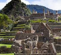
View of the residential section of Machu Picchu
Some Inca buildings were constructed using mortar, but by Inca standards this was quick, shoddy construction, and was not used in the building of important structures. Peru is a highly seismic land, and mortar-free construction was more earthquake-resistant than using mortar. The stones of the dry-stone walls built by the Incas can move slightly and resettle without the walls collapsing.
A llama at Machu Picchu.
Inca walls had numerous design details that helped protect them against collapsing in an earthquake. Doors and windows are trapezoidal and tilt inward from bottom to top; corners usually are rounded; inside corners often incline slightly into the rooms; and "L"-shaped blocks often were used to tie outside corners of the structure together. These walls do not rise straight from bottom to top but are offset slightly from row to row.
The Incas never used the wheel in any practical manner. Its use in toys demonstrates that the principle was well-known to them, although it was not applied in their engineering. The lack of strong draft animals, as well as steep terrain and dense vegetation issues, may have rendered the wheel impractical. How they moved and placed the enormous blocks of stones remains a mystery, although the general belief is that they used hundreds of men to push the stones up inclined planes. A few of the stones still have knobs on them that could have been used to lever them into position; it is believed that after the stones were placed, the Incas would have sanded the knobs away, but a few were overlooked.
The space is composed of 140 structures or features, including temples, sanctuaries, parks, and residences that include houses with thatched roofs. There are more than one hundred flights of stone steps –often completely carved from a single block of granite –and numerous water fountains. These were interconnected by channels and water-drains perforated in the rock that were designed for the original irrigation system. Evidence suggests that the irrigation system was used to carry water from a holy spring to each of the houses in turn.
According to archaeologists, the urban sector of Machu Picchu was divided into three great districts: the Sacred District, the Popular District to the south, and the District of the Priests and the Nobility.
Temple of the Sun at Machu Picchu
Located in the first zone are the primary archaeological treasures: the Intihuatana, the Temple of the Sun and the Room of the Three Windows. These were dedicated to Inti, their sun god and greatest deity. The Popular District, or Residential District, is the place where the lower-class people lived. It includes storage buildings and simple houses.
The royalty area, a sector for the nobility, is a group of houses located in rows over a slope; the residence of the Amautas (wise persons) was characterized by its reddish walls, and the zone of the Ñustas (princesses) had trapezoid-shaped rooms. The Monumental Mausoleum is a carved statue with a vaulted interior and carved drawings. It was used for rites or sacrifices.
As part of their road system, the Incas built a road to the Machu Picchu region. Today, tens of thousands of tourists walk the Inca Trail to visit Machu Picchu each year. They acclimatise at Cusco before starting on the two- to four-day journey on foot from the Urubamba valley, walking up through the Andes mountain range to the isolated city.
The people of Machu Picchu were connected to long-distance trade, as shown by non-local artifacts found at the site. As an example, Bingham found unmodified obsidian nodules at the entrance gateway. In the 1970s, Burger and Asaro determined that these obsidian samples were from the Titicaca or Chivay obsidian source, and that the samples from Machu Picchu showed long-distance transport of this obsidian type in pre-Hispanic Peru.[15]
The Guardhouse is a three-sided building, with one of its long sides opening onto the Terrace of the Ceremonial Rock. The three-sided style of Inca architecture is known as the wayrona style.[16]
[edit] 3D laser scanning of site
In 2005 and 2009, the University of Arkansas made detailed laser scans of the entire Machu Picchu site and of the ruins at the top of the adjacent Huayna Picchu mountain. The university has made the scan data available online for research purposes.[17]
[edit] January 2010 evacuation
See also: El Niño-Southern Oscillation
In January 2010, heavy rain caused flooding which buried or washed away roads and railways leading to Machu Picchu, trapping more than 2,000 locals and over 2,000 tourists, who were taken out by airlift. Machu Picchu was temporarily closed,[18] but it reopened on 28 February 2010.[19]
[edit] Intihuatana stone
The Intihuatana ("sun-tier") is believed to have been designed as an astronomic clock or calendar by the Incas
The Intihuatana stone is one of many ritual stones in South America. These stones are arranged to point directly at the sun during the winter solstice. The name of the stone (coined perhaps by Bingham) is derived from the Quechua language: inti means 'sun', and wata- is the verb root 'to tie, hitch (up)' ('huata-' is simply a Spanish spelling). The Quechua -na suffix derives nouns for tools or places. Hence inti watana is literally an instrument or place to 'tie up the sun', often expressed in English as "The Hitching Post of the Sun". The Inca believed the stone held the sun in its place along its annual path in the sky. At midday on October 27 and February 14, the sun stands almost above the pillar, casting no shadow at all. Researchers believe that it was built as an astronomic clock or calendar.
[edit] Concerns over tourism
Machu Picchu is a UNESCO World Heritage Site. Since its discovery in 1911, a growing number of tourists visit Machu Picchu, reaching 400,000 in 2003.[20] As Peru's most visited tourist attraction and major revenue generator, it is continually threatened by economic and commercial forces. In the late 1990s, the Peruvian government granted concessions to allow the construction of a cable car and development of a luxury hotel, including a tourist complex with boutiques and restaurants. Many people protested against the plans, including members of the Peruvian public, international scientists, and academics, as they were worried that the greater numbers of visitors would pose a tremendous physical burden on the ruins.[21] Many protested a plan to build a bridge to the site as well.[22] A no-fly zone exists above the area.[23] UNESCO is considering putting Machu Picchu on its List of World Heritage Sites in Danger.[22]
During the 1980s a large rock from Machu Picchu's central plaza was moved out of its alignment to a different location to create a helicopter landing zone. Since the 1990s, the government has forbidden helicopter landings there. In 2006 a Cusco-based company, Helicusco, sought to have tourist flights over Machu Picchu and initially received a license to do so, but the government quickly overturned the decision.[24]
View of Machu Picchu from Huayna Picchu, showing the Hiram Bingham Highway used by tour buses to and from the town of Aguas Calientes
[edit] Controversy with Yale University
In 1912 and 1914–15, Bingham excavated treasures from Machu Picchu—ceramic vessels, silver statues, jewelry and human bones—and took them from Peru to Yale University in the United States for further study, supposedly for a period of 18 months. Yale has retained the artifacts until now, under the argument that Peru did not have the infrastructure or proper conditions to take care of the pieces.
Eliane Karp, an anthropologist who is married to the former Peruvian President Alejandro Toledo, accused Yale of profiting from Peru's cultural heritage by claiming title to thousands of pieces removed by Bingham. Many have been on display at Yale's Peabody Museum since. Yale returned some of the artifacts to Peru, but the university kept the remainder, claiming its position was supported by federal case law involving Peruvian antiquities.[25]
On 19 September 2007, the Courant reported that Peru and Yale had reached an agreement regarding the requested return of the artifacts. The agreement includes sponsorship of a joint traveling exhibition and construction of a new museum and research center in Cusco about which Yale will advise Peruvian officials. Yale acknowledges Peru's title to all the excavated objects from Machu Picchu, but Yale will share rights with Peru in the research collection, part of which will remain at Yale as an object of continuing study.[26]
On 19 June 2008, National Geographic Society's vice-president Terry Garcia was quoted by daily La República. "We were part of this agreement. National Geographic was there, we know what was said, the objects were lent and should be returned."
On 21 November 2010, Yale University agreed in principle to the return of the controversial artifacts to their original home in Peru.
Panoramic photograph of Machu Picchu, looking towards Huayna Picchu
achu Picchu (Quechua: Machu Pikchu) – "Old Peaks", pronounced [ˈmɑtʃu ˈpixtʃu]) – is a pre-Columbian 15th-century Inca site located 2,430 metres (7,970 ft) above sea level.[1][2] It is situated on a mountain ridge above the Urubamba Valley in Peru, which is 80 kilometres (50 mi) northwest of Cusco and through which the Urubamba River flows. Most archaeologists believe that Machu Picchu was built as an estate for the Inca emperor Pachacuti (1438–1472). Often referred to as "The Lost City of the Incas", it is perhaps the most familiar icon of the Inca World.
The Incas started building the estate around AD 1400 but abandoned it as an official site for the Inca rulers a century later at the time of the Spanish Conquest. Although known locally, it was unknown to the outside world before being brought to international attention in 1911 by the American historian Hiram Bingham. Since then, Machu Picchu has become an important tourist attraction.
Since the site was never known to the Spanish during their conquest, it is highly significant as a relatively intact cultural site. Machu Picchu was declared a Peruvian Historical Sanctuary in 1981 and a UNESCO World Heritage Site in 1983.[2] In 2007, Machu Picchu was voted one of the New Seven Wonders of the World in a worldwide Internet poll.
Machu Picchu was built in the classical Inca style, with polished dry-stone walls. Its three primary buildings are the Intihuatana, the Temple of the Sun, and the Room of the Three Windows. These are located in what is known by archaeologists as the Sacred District of Machu Picchu. In September 2007, Peru and Yale University almost reached an agreement regarding the return of artifacts which Yale has held since Hiram Bingham removed them from Machu Picchu in the early 20th century. In November 2010, a Yale University representative agreed to return the artifacts to a Peruvian university.[3]
Contents
[hide]
* 1 History
o 1.1 Early encounters
* 2 Geography
* 3 The site
o 3.1 3D laser scanning of site
o 3.2 January 2010 evacuation
* 4 Intihuatana stone
* 5 Concerns over tourism
* 6 Controversy with Yale University
* 7 In media
* 8 Twin towns
* 9 See also
* 10 References
o 10.1 Bibliography
* 11 Further reading
* 12 External links
o 12.1 Images
[edit] History
Machu Picchu was built around 1450, at the height of the Inca Empire.[4] It was abandoned just over 100 years later, in 1572, as a belated result of the Spanish Conquest.[4][5] It is likely that most of its inhabitants died from smallpox introduced by travelers before the Spanish conquistadores arrived in the area.[citation needed] The latter had notes of a place called Piccho, although there is no record of the Spanish having visited the remote city. The types of sacred rocks defaced by the conquistadors in other locations are untouched at Machu Picchu.[5]
Hiram Bingham theorized that the complex was the traditional birthplace of the Incan "Virgins of the Suns".[6] More recent research by scholars such as John Rowe and Richard Burger, has convinced most archaeologists that Machu Picchu was an estate of the Inca emperor Pachacuti.[5] In addition, Johan Reinhard presented evidence that the site was selected because of its position relative to sacred landscape features such as its mountains, which are purported to be in alignment with key astronomical events important to the Incas.
Johan Reinhard believes Machu Picchu to be a sacred religious site. This theory stands mainly because of where Machu Picchu is located. Reinhard calls it "sacred geography" because the site is built on and around mountains that hold high religious importance in the Inca culture and in culture that previously occupied the land. At the highest point of the mountain in which Machu Picchu was named after, there are “artificial platforms [and] these had a religious function, as is clear from the Inca ritual offerings found buried under them” (Reinhard 2007). These platforms are also found in other Incan religious sites. The site’s other stone structures have finely worked stones with niches and from what the “Spaniards wrote about Inca sites, we know that these [types of] building[s] were of ritual significance” (Reinhard 2007). This would be the most convincing evidence that Reinhard points out because this type of stylistic stonework is only found at the religious sites so it would be natural that they would put it into this religious site. [7] Another theory maintains that Machu Picchu was an Inca llaqta, a settlement built to control the economy of conquered regions. Yet another asserts that it may have been built as a prison for a select few who had committed heinous crimes against Inca society. An alternative theory is that it is an agricultural testing station. Different types of crops could be tested in the many different micro-climates afforded by the location and the terraces; these were not large enough to grow food on a large scale, but may have been used to determine what could grow where. Another theory suggests that the city was built for the gods to live in, or for the coronation of kings.[8]
View of the city of Machu Picchu in 1911
Although the citadel is located only about 80 kilometers (50 miles) from Cusco, the Inca capital, the Spanish never found it and consequently did not plunder or destroy it, as they did many other sites.[5] Over the centuries, the surrounding jungle grew over much of the site, and few outsiders knew of its existence.
On 24 July 1911, Hiram Bingham announced the find of Machu Picchu to scholars. An American historian employed as a lecturer at Yale University, Bingham had been searching for the city of Vilcabamba, the last Inca refuge during the Spanish conquest. He had worked for years in previous trips and explorations around the zone. Pablito Alvarez, a local 11 year-old Quechuas boy, led Bingham up to Machu Picchu.[5][9] Some Quechuas lived in the original structures at Machu Picchu.
Bingham started archaeological studies and completed a survey of the area. He called the complex "The Lost City of the Incas", which was the title of his first book. Bingham made several more trips and conducted excavations on the site through 1915, collecting various artifacts which he took back to Yale. He wrote a number of books and articles about the discovery of Machu Picchu.
A complete overview of the site as seen from Huayna Picchu
The site received significant publicity after the National Geographic Society devoted their entire April 1913 issue to Machu Picchu.
In 1981 Peru declared an area of 325.92 square kilometers surrounding Machu Picchu as a "Historical Sanctuary". In addition to the ruins, the sanctuary includes a large portion of the adjoining region, rich with flora and fauna.
In 1983 UNESCO designated Machu Picchu a World Heritage Site, describing it as "an absolute masterpiece of architecture and a unique testimony to the Inca civilization".[1]
The World Monuments Fund placed Machu Picchu on its 2008 Watch List of the 100 Most Endangered Sites in the world because of environmental degradation. This has resulted from the impact of tourism, uncontrolled development in the nearby town of Aguas Calientes, which included a poorly sited tram to ease visitor access, and the construction of a bridge across the Vilcanota River, which is likely to bring even more tourists to the site, in defiance of a court order and government protests against it.
[edit] Early encounters
Man sitting on ruins, hand-colored glass slide by Harry Ward Foote, who accompanied Hiram Bingham to Machu Picchu, 1911
Although Bingham was the first person to bring word of the ruins to the outside world, other outsiders were said to have seen Machu Picchu before him. Simone Waisbard, a long-time researcher of Cusco, claims that Enrique Palma, Gabino Sánchez, and Agustín Lizárraga left their names engraved on one of the rocks at Machu Picchu on 14 July 1901. In 1904, an engineer named Franklin supposedly spotted the ruins from a distant mountain. He told Thomas Payne, an English Christian missionary living in the region, about the site, Payne's family members claim. They also report that in 1906, Payne and fellow missionary Stuart E. McNairn (1867–1956) climbed up to the ruins.
The site may have been discovered and plundered in 1867 by a German businessman, Augusto Berns.[10] There is some evidence that a German engineer, J. M. von Hassel, arrived earlier. Maps found by historians show references to Machu Picchu as early as 1874.[11]
[edit] Geography
Map of Machu Picchu
Machu Picchu lies in the southern hemisphere, some 13 degrees south of the equator.[12] It is 80 kilometers northwest of Cusco, on the crest of the mountain Machu Picchu, located about 2,450 metres (8,040 ft) above mean sea level, over 1,000 metres (3,300 ft) lower than Cusco, which has an altitude of 3,600 metres (11,800 ft).[12] As such, it had a milder climate than the Inca capital. It is one of the most important archaeological sites in South America, one of the most visited tourist attractions in all of Latin America[13] and the most visited tourist attraction in Peru.
The year at Machu Picchu is divided between wet and dry seasons, with the majority of annual rain falling from October through to April. It can rain at any time of the year.[12]
Machu Picchu is situated above a loop of the Urubamba River, which surrounds the site on three sides, with cliffs dropping vertically for 450 metres (1,480 ft) to the river at their base. The area is subject to morning mists rising from the river.[5] The location of the city was a military secret, and its deep precipices and steep mountains provided excellent natural defenses. The Inca Bridge, an Inca rope bridge, across the Urubamba River in the Pongo de Mainique, provided a secret entrance for the Inca army. Another Inca bridge was built to the west of Machu Picchu, the tree-trunk bridge, at a location where a gap occurs in the cliff that measures 6 metres (20 ft). It could be bridged by two tree trunks, but with the trees removed, there was a 570 metres (1,870 ft) fall to the base of the cliffs.
The city sits in a saddle between the two mountains Machu Picchu and Huayna Picchu,[5] with a commanding view down two valleys and a nearly impassable mountain at its back. It has a water supply from springs that cannot be blocked easily, and enough land to grow food for about four times as many people as ever lived there. The hillsides leading to it have been terraced, not only to provide more farmland to grow crops, but to steepen the slopes which invaders would have to ascend. The terraces reduced soil erosion and protected against landslides.[14] Two high-altitude routes from Machu Picchu go across the mountains back to Cusco, one through the sun gate, and the other across the Inca bridge. Both could be easily blocked, should invaders approach along them. Regardless of its original purpose, it is strategically located and readily defended.
[edit] The site
Main article: Incan architecture
Partially restored Inca building
The ruins of Machu Picchu are divided into two main sections known as the Urban and Agricultural Sectors, divided by a wall. The Agricultural Sector is further subdivided into Upper and Lower sectors, while the Urban Sector is split into East and West sectors, separated by wide plazas.[5]
The central buildings of Machu Picchu use the classical Inca architectural style of polished dry-stone walls of regular shape. The Incas were masters of this technique, called ashlar, in which blocks of stone are cut to fit together tightly without mortar. Many junctions in the central city are so perfect that it is said not even a blade of grass fits between the stones.
Terraced Fields of Machu Picchu
View of the residential section of Machu Picchu
Some Inca buildings were constructed using mortar, but by Inca standards this was quick, shoddy construction, and was not used in the building of important structures. Peru is a highly seismic land, and mortar-free construction was more earthquake-resistant than using mortar. The stones of the dry-stone walls built by the Incas can move slightly and resettle without the walls collapsing.
A llama at Machu Picchu.
Inca walls had numerous design details that helped protect them against collapsing in an earthquake. Doors and windows are trapezoidal and tilt inward from bottom to top; corners usually are rounded; inside corners often incline slightly into the rooms; and "L"-shaped blocks often were used to tie outside corners of the structure together. These walls do not rise straight from bottom to top but are offset slightly from row to row.
The Incas never used the wheel in any practical manner. Its use in toys demonstrates that the principle was well-known to them, although it was not applied in their engineering. The lack of strong draft animals, as well as steep terrain and dense vegetation issues, may have rendered the wheel impractical. How they moved and placed the enormous blocks of stones remains a mystery, although the general belief is that they used hundreds of men to push the stones up inclined planes. A few of the stones still have knobs on them that could have been used to lever them into position; it is believed that after the stones were placed, the Incas would have sanded the knobs away, but a few were overlooked.
The space is composed of 140 structures or features, including temples, sanctuaries, parks, and residences that include houses with thatched roofs. There are more than one hundred flights of stone steps –often completely carved from a single block of granite –and numerous water fountains. These were interconnected by channels and water-drains perforated in the rock that were designed for the original irrigation system. Evidence suggests that the irrigation system was used to carry water from a holy spring to each of the houses in turn.
According to archaeologists, the urban sector of Machu Picchu was divided into three great districts: the Sacred District, the Popular District to the south, and the District of the Priests and the Nobility.
Temple of the Sun at Machu Picchu
Located in the first zone are the primary archaeological treasures: the Intihuatana, the Temple of the Sun and the Room of the Three Windows. These were dedicated to Inti, their sun god and greatest deity. The Popular District, or Residential District, is the place where the lower-class people lived. It includes storage buildings and simple houses.
The royalty area, a sector for the nobility, is a group of houses located in rows over a slope; the residence of the Amautas (wise persons) was characterized by its reddish walls, and the zone of the Ñustas (princesses) had trapezoid-shaped rooms. The Monumental Mausoleum is a carved statue with a vaulted interior and carved drawings. It was used for rites or sacrifices.
As part of their road system, the Incas built a road to the Machu Picchu region. Today, tens of thousands of tourists walk the Inca Trail to visit Machu Picchu each year. They acclimatise at Cusco before starting on the two- to four-day journey on foot from the Urubamba valley, walking up through the Andes mountain range to the isolated city.
The people of Machu Picchu were connected to long-distance trade, as shown by non-local artifacts found at the site. As an example, Bingham found unmodified obsidian nodules at the entrance gateway. In the 1970s, Burger and Asaro determined that these obsidian samples were from the Titicaca or Chivay obsidian source, and that the samples from Machu Picchu showed long-distance transport of this obsidian type in pre-Hispanic Peru.[15]
The Guardhouse is a three-sided building, with one of its long sides opening onto the Terrace of the Ceremonial Rock. The three-sided style of Inca architecture is known as the wayrona style.[16]
[edit] 3D laser scanning of site
In 2005 and 2009, the University of Arkansas made detailed laser scans of the entire Machu Picchu site and of the ruins at the top of the adjacent Huayna Picchu mountain. The university has made the scan data available online for research purposes.[17]
[edit] January 2010 evacuation
See also: El Niño-Southern Oscillation
In January 2010, heavy rain caused flooding which buried or washed away roads and railways leading to Machu Picchu, trapping more than 2,000 locals and over 2,000 tourists, who were taken out by airlift. Machu Picchu was temporarily closed,[18] but it reopened on 28 February 2010.[19]
[edit] Intihuatana stone
The Intihuatana ("sun-tier") is believed to have been designed as an astronomic clock or calendar by the Incas
The Intihuatana stone is one of many ritual stones in South America. These stones are arranged to point directly at the sun during the winter solstice. The name of the stone (coined perhaps by Bingham) is derived from the Quechua language: inti means 'sun', and wata- is the verb root 'to tie, hitch (up)' ('huata-' is simply a Spanish spelling). The Quechua -na suffix derives nouns for tools or places. Hence inti watana is literally an instrument or place to 'tie up the sun', often expressed in English as "The Hitching Post of the Sun". The Inca believed the stone held the sun in its place along its annual path in the sky. At midday on October 27 and February 14, the sun stands almost above the pillar, casting no shadow at all. Researchers believe that it was built as an astronomic clock or calendar.
[edit] Concerns over tourism
Machu Picchu is a UNESCO World Heritage Site. Since its discovery in 1911, a growing number of tourists visit Machu Picchu, reaching 400,000 in 2003.[20] As Peru's most visited tourist attraction and major revenue generator, it is continually threatened by economic and commercial forces. In the late 1990s, the Peruvian government granted concessions to allow the construction of a cable car and development of a luxury hotel, including a tourist complex with boutiques and restaurants. Many people protested against the plans, including members of the Peruvian public, international scientists, and academics, as they were worried that the greater numbers of visitors would pose a tremendous physical burden on the ruins.[21] Many protested a plan to build a bridge to the site as well.[22] A no-fly zone exists above the area.[23] UNESCO is considering putting Machu Picchu on its List of World Heritage Sites in Danger.[22]
During the 1980s a large rock from Machu Picchu's central plaza was moved out of its alignment to a different location to create a helicopter landing zone. Since the 1990s, the government has forbidden helicopter landings there. In 2006 a Cusco-based company, Helicusco, sought to have tourist flights over Machu Picchu and initially received a license to do so, but the government quickly overturned the decision.[24]
View of Machu Picchu from Huayna Picchu, showing the Hiram Bingham Highway used by tour buses to and from the town of Aguas Calientes
[edit] Controversy with Yale University
In 1912 and 1914–15, Bingham excavated treasures from Machu Picchu—ceramic vessels, silver statues, jewelry and human bones—and took them from Peru to Yale University in the United States for further study, supposedly for a period of 18 months. Yale has retained the artifacts until now, under the argument that Peru did not have the infrastructure or proper conditions to take care of the pieces.
Eliane Karp, an anthropologist who is married to the former Peruvian President Alejandro Toledo, accused Yale of profiting from Peru's cultural heritage by claiming title to thousands of pieces removed by Bingham. Many have been on display at Yale's Peabody Museum since. Yale returned some of the artifacts to Peru, but the university kept the remainder, claiming its position was supported by federal case law involving Peruvian antiquities.[25]
On 19 September 2007, the Courant reported that Peru and Yale had reached an agreement regarding the requested return of the artifacts. The agreement includes sponsorship of a joint traveling exhibition and construction of a new museum and research center in Cusco about which Yale will advise Peruvian officials. Yale acknowledges Peru's title to all the excavated objects from Machu Picchu, but Yale will share rights with Peru in the research collection, part of which will remain at Yale as an object of continuing study.[26]
On 19 June 2008, National Geographic Society's vice-president Terry Garcia was quoted by daily La República. "We were part of this agreement. National Geographic was there, we know what was said, the objects were lent and should be returned."
On 21 November 2010, Yale University agreed in principle to the return of the controversial artifacts to their original home in Peru.
Panoramic photograph of Machu Picchu, looking towards Huayna Picchu
victoria falls
From Wikipedia, the free encyclopedia
he Victoria Falls or Mosi-o-Tunya (the Smoke that Thunders) is a waterfall located in southern Africa on the Zambezi River between the countries of Zambia and Zimbabwe. The falls are some of the largest in the world.
Contents
[hide]
* 1 Introduction
* 2 Physical features
o 2.1 Flood and dry season flow rates
* 3 The Victoria Falls Gorges
* 4 Formation
* 5 Pre-colonial history
* 6 History since 1900
o 6.1 The Victoria Falls Bridge initiates tourism
o 6.2 Zambia's independence and Rhodesia's UDI
o 6.3 Tourism in recent years
* 7 Natural environment
o 7.1 National parks
o 7.2 Vegetation
o 7.3 Wildlife
o 7.4 Fish
* 8 Media
* 9 See also
* 10 References
* 11 External links
[edit] Introduction
At lower water levels, more of the First Gorge can be seen.
The Victoria Falls are some of the most famous, considered by some to be among the Seven Natural Wonders of the World.[1] David Livingstone, the Scottish missionary and explorer, is believed to have been the first European recorded to view the Victoria Falls — which he did from what is now known as 'Livingstone Island' in Zambia, the only land accessible in the middle of the falls.[2] David Livingstone gave the falls the name 'Victoria Falls' in honour of his Queen, but the indigenous name of 'Mosi-oa-Tunya' — literally meaning the 'Smoke that Thunders' — is also well known. The World Heritage List recognizes both names.[3] While it is neither the highest nor the widest waterfall in the world, it is claimed to be the largest. This claim is based on a width of 1,708 metres (5,604 ft)[4] and height of 108 metres (354 ft), forming the largest sheet of falling water in the world. The falls' maximum flow rate compares well with that of other major waterfalls (see table below).[3]
[edit] Physical features
The Eastern Cataract, on the Zambian side.
For a considerable distance upstream from the falls, the Zambezi flows over a level sheet of basalt, in a shallow valley bounded by low and distant sandstone hills. The river's course is dotted with numerous tree-covered islands, which increase in number as the river approaches the falls. There are no mountains, escarpments, or deep valleys which might be expected to create a waterfall, only flat plateau extending hundreds of kilometres in all directions.[5]
The falls are formed as the full width of the river plummets in a single vertical drop into a transverse chasm 1708 meters (5604 ft) wide, carved by its waters along a fracture zone in the basalt plateau. The depth of the chasm, called the First Gorge, varies from 80 metres (260 ft) at its western end to 108 metres (354 ft) in the centre. The only outlet to the First Gorge is a 110 metres (360 ft) wide gap about two-thirds of the way across the width of the falls from the western end, through which the whole volume of the river pours into the Victoria Falls gorges.[5]
There are two islands on the crest of the falls that are large enough to divide the curtain of water even at full flood: Boaruka Island (or Cataract Island) near the western bank, and Livingstone Island near the middle — the place that David Livingstone first saw the falls from in Zambia. At less than full flood, additional islets divide the curtain of water into separate parallel streams. The main streams are named, in order from Zimbabwe (west) to Zambia (east): Devil's Cataract (called Leaping Water by some), Main Falls, Rainbow Falls (the highest) and the Eastern Cataract.[5]
[edit] Flood and dry season flow rates
Victoria Falls from the air 1972.jpg Victoria5.jpg
‘The Smoke that Thunders’, rainy season, 1972 ... and dry season, September 2003
Size and flow rate of Victoria Falls with Niagara and Iguazu for comparison
Parameters Victoria Falls Niagara Falls Iguazu Falls
Height in meters and feet:[3] 108m 360 ft 51 m 167 ft 64–82 m 210–269 ft
Width in meters and feet:[3] 1,708 m 5,604 ft 1,203 m 3,947 ft 2,700 m 8,858 ft
Flow rate units (vol/s): m³/s cu ft/s m³/s cu ft/s m³/s cu ft/s
Mean annual flow rate:[3] 1,088 38,430 2,407 85,000 1,746 61,600
Mean monthly flow[6] — max: 3,000 105,944
— min:[6] 300 10,594
— 10yr max:[6] 6,000 211,888
Highest recorded flow:[3] 12,800 452,000 6,800 240,000 12,600 444,965
Notes: See references for explanation of measurements.
For water, cubic metres per second = tonnes per second.
Half the water approaching Niagara is diverted for hydroelectric power.
Iguazu has two drops; height given for biggest drop and total height.
10 falls have greater or equal flow rates, but are not as high as Iguazu and Victoria Falls.[6]
The Zambezi basin above the falls experiences a rainy season from late November to early April, and a dry season the rest of the year. The river's annual flood season is February to May with a peak in April,[6] The spray from the falls typically rises to a height of over 400 metres (1,300 ft), and sometimes even twice as high, and is visible from up to 50 km (30 miles) away. At full moon, a "moonbow" can be seen in the spray instead of the usual daylight rainbow. During the flood season, however, it is impossible to see the foot of the falls and most of its face, and the walks along the cliff opposite it are in a constant shower and shrouded in mist. Close to the edge of the cliff, spray shoots upward like inverted rain, especially at Zambia's Knife-Edge Bridge.[5]
As the dry season takes effect, the islets on the crest become wider and more numerous, and in September to January up to half of the rocky face of the falls may become dry and the bottom of the First Gorge can be seen along most of its length. At this time it becomes possible (though not necessarily safe) to walk across some stretches of the river at the crest. It is also possible to walk to the bottom of the First Gorge at the Zimbabwean side. The minimum flow, which occurs in November, is around a tenth of the April figure; this variation in flow is greater than that of other major falls, and causes Victoria Falls' annual average flow rate to be lower than might be expected based on the maximum flow.[5]
Victoria Falls is roughly twice the height of North America's Niagara Falls and well over twice the width of its Horseshoe Falls. In height and width Victoria Falls is rivalled only by South America's Iguazu Falls. See table for comparisons.
[edit] The Victoria Falls Gorges
Satellite image showing the broad Zambezi falling into the narrow cleft and subsequent series of zigzagging gorges (top of picture is north).
Victoria Falls Bridge spanning the Second Gorge.
The whole volume of the Zambezi River pours through the First Gorge's 110-meter-wide (360 ft) exit for a distance of about 150 meters (500 ft), then enters a zigzagging series of gorges designated by the order in which the river reaches them. Water entering the Second Gorge makes a sharp right turn and has carved out a deep pool there called the Boiling Pot. Reached via a steep footpath from the Zambian side, it is about 150 metres (500 ft) across. Its surface is smooth at low water, but at high water is marked by enormous, slow swirls and heavy boiling turbulence.[5] Objects—and humans—that are swept over the falls, including the occasional hippo, are frequently found swirling about here or washed up at the north-east end of the Second Gorge. This is where the bodies of Mrs Moss and Mr Orchard, mutilated by crocodiles, were found in 1910 after two canoes were capsized by a hippo at Long Island above the falls.[7]
The principal gorges are (see reference for note about these measurements):[8]
* First Gorge: the one the river falls into at Victoria Falls
* Second Gorge: (spanned by the Victoria Falls Bridge), 250 m south of falls, 2.15 km long (270 yd south, 2350 yd long)
* Third Gorge: 600 m south, 1.95 km long (650 yd south, 2100 yd long), containing the Victoria Falls Power Station.
* Fourth Gorge: 1.15 km south, 2.25 km long (1256 yd south, 2460 yd long)
* Fifth Gorge: 2.55 km south, 3.2 km long (1.5 mi south, 2 mi long)
* Songwe Gorge: 5.3 km south, 3.3 km long, (3.3 mi south, 2 mi long) named after the small Songwe River coming from the north-east, and the deepest at 140 m (460 ft), at the end of the dry season.
* Batoka Gorge: The gorge below the Songwe is called the Batoka Gorge (which is also used as an umbrella name for all the gorges). It is about 120 kilometres (75 mi) long (the straight line distance to its end is about 80 kilometres (50 mi) east of the falls) and takes the river through the basalt plateau to the valley in which Lake Kariba now lies.
The walls of the gorges are nearly vertical and generally about 120 metres (400 ft) high, but the level of the river in them varies by up to 20 meters (65 ft) between wet and dry seasons.[5]
[edit] Formation
"Devil's Cataract", the westernmost cataract of Victoria Falls and the start of a line of weakness where the next falls will form.
The recent geological history of Victoria Falls can be seen in the form of the gorges below the falls. The basalt plateau over which the Upper Zambezi flows has many large cracks filled with weaker sandstone. In the area of the current falls the largest cracks run roughly east to west (some run nearly north-east to south-west), with smaller north-south cracks connecting them.
Over at least 100,000 years, the falls have been receding upstream through the Batoka Gorges, eroding the sandstone-filled cracks to form the gorges. The river's course in the current vicinity of the falls is north to south, so it opens up the large east-west cracks across its full width, then it cuts back through a short north-south crack to the next east-west one. The river has fallen in different eras into different chasms which now form a series of sharply zig-zagging gorges downstream from the falls. [5]
Ignoring some dry sections, the Second to Fifth and the Songwe Gorges each represents a past site of the falls at a time when they fell into one long straight chasm as they do now.[5] Their sizes indicate that we are not living in the age of the widest-ever falls.
The falls have already started cutting back the next major gorge, at the dip in one side of the "Devil's Cataract" (also known as "Leaping Waters") section of the falls. This is not actually a north-south crack, but a large east-northeast line of weakness across the river, where the next full-width falls will eventually form.
Further geological history of the course of the Zambezi River is in the article of that name.
[edit] Pre-colonial history
Archaeological sites around the falls have yielded Homo habilis stone artifacts from 3 million years ago, 50,000-year-old Middle Stone Age tools and Late Stone Age (10,000 and 2,000 years ago) weapons, adornments and digging tools.[9] Iron-using Khoisan hunter-gatherers displaced these Stone Age people and in turn were displaced by Bantu tribes such as the southern Tonga people known as the Batoka/Tokalea, who called the falls Shungu na mutitima. The Matabele, later arrivals, named them aManz' aThunqayo, and the Batswana and Makololo (whose language is used by the Lozi people) call them Mosi-o-Tunya. All these names mean essentially "the smoke that thunders".[10]
The first European to see the falls was David Livingstone on 17 November 1855, during his 1852–56 journey from the upper Zambezi to the mouth of the river. The falls were well known to local tribes, and Voortrekker hunters may have known of them, as may the Arabs under a name equivalent to "the end of the world". Europeans were sceptical of their reports, perhaps thinking that the lack of mountains and valleys on the plateau made a large falls unlikely.[11][12]
Livingstone had been told about the falls before he reached them from upriver and was paddled across to a small island that now bears the name Livingstone Island in Zambia. Livingstone had previously been impressed by the Ngonye Falls further upstream, but found the new falls much more impressive, and gave them their English name in honour of Queen Victoria. He wrote of the falls, "No one can imagine the beauty of the view from anything witnessed in England. It had never been seen before by European eyes; but scenes so lovely must have been gazed upon by angels in their flight."[5]
In 1860, Livingstone returned to the area and made a detailed study of the falls with John Kirk. Other early European visitors included Portuguese explorer Serpa Pinto, Czech explorer Emil Holub, who made the first detailed plan of the falls and its surroundings in 1875 (published in 1880),[13] and British artist Thomas Baines, who executed some of the earliest paintings of the falls. Until the area was opened up by the building of the railway in 1905, though, the falls were seldom visited by other Europeans.
[edit] History since 1900
Mosi-oa-Tunya / Victoria Falls*
UNESCO World Heritage Site
Victoria Falls' Second Gorge (with bridge) and Third Gorge (right). The peninsular cliffs are in Zambia, the outer cliffs in Zimbabwe.
State Party Zambia and Zimbabwe
Type Natural
Criteria vii, viii
Reference 509
Region** Africa
Inscription history
Inscription 1989 (13th Session)
* Name as inscribed on World Heritage List.
** Region as classified by UNESCO.
[edit] The Victoria Falls Bridge initiates tourism
European settlement of the Victoria Falls area started around 1900 in response to the desire of Cecil Rhodes' British South Africa Company for mineral rights and imperial rule north of the Zambezi, and the exploitation of other natural resources such as timber forests north-east of the falls, and ivory and animal skins. Before 1905, the river was crossed above the falls at the Old Drift, by dugout canoe or a barge towed across with a steel cable.[7] Rhodes' vision of a Cape-Cairo railway drove plans for the first bridge across the Zambezi and he insisted it be built where the spray from the falls would fall on passing trains, so the site at the Second Gorge was chosen. See the main article Victoria Falls Bridge for details.[5] From 1905 the railway offered accessible travel to whites from as far as the Cape in the south and from 1909, as far as the Belgian Congo in the north. The falls became an increasingly popular attraction during British colonial rule of Northern Rhodesia (Zambia) and Southern Rhodesia (Zimbabwe), with the town of Victoria Falls becoming the main tourist centre.
[edit] Zambia's independence and Rhodesia's UDI
In 1964, Northern Rhodesia became the independent state of Zambia. The following year, Rhodesia unilaterally declared independence. This was not recognized by Zambia, the United Kingdom or the vast majority of states and led to UN-mandated sanctions. In response to the emerging crisis, in 1966 Zambia restricted or stopped border crossings; it did not re-open the border completely until 1980. Guerilla warfare arose on the southern side of the Zambezi from 1972: the Zimbabwe-Rhodesia War. Visitor numbers began to drop, particularly on the Rhodesian (Zimbabwean) side. The war affected Zambia through military incursions, causing the latter to impose security measures including the stationing of soldiers to restrict access to the gorges and some parts of the falls.
Zimbabwean independence in 1980 brought comparative peace, and the 1980s witnessed renewed levels of tourism and the development of the region as a centre for adventure sports. Activities that gained popularity in the area include whitewater rafting in the gorges, bungee jumping from the bridge, game fishing, horse riding, kayaking, and flights over the falls.[9]
[edit] Tourism in recent years
"Devil's Pool", a naturally formed safe swimming pool.
Victoria Falls entrance
By the end of the 1990s, almost 300,000 people were visiting the falls annually, and this was expected to rise to over a million in the next decade. Unlike the game parks, Victoria Falls has more Zimbabwean and Zambian visitors than international tourists as they are accessible by bus and train and therefore comparatively inexpensive to reach. This waterfall was the very first destination ever to be visited in The Amazing Race.[9]
The two countries permit tourists to make day trips from one side to the other without the necessity of obtaining a visa in advance, but visas issued at the border are expensive, particularly upon entering Zimbabwe. In 2008 Zambia increased the prices of their visas, and a U.S. or U.K. citizen can expect to pay US$135 or US$140 for a 3-year multiple-entry visa. Citizens of other nations will pay varying rates for a 3-month Visa, typically about £50, but may need to purchase a visa each time they cross the border.[14]
A famous feature is a naturally formed pool known as the Devil's Pool, near the edge of the falls, accessed via Livingstone Island in Zambia. When the river flow is at a safe level, usually during the months of September and December, people can swim as close as possible to the edge of the falls within the pool without continuing over the edge and falling into the gorge; this is possible due to a natural rock wall just below the water and at the very edge of the falls that stops their progress despite the current.[15][16] Even so, an average of one person per year dies while swimming in Devil's Pool.[17]
The numbers of visitors to the Zimbabwean side of the falls has historically been much higher than the number visiting the Zambia side, due to the greater development of the visitor facilities there. However, the number of tourists visiting Zimbabwe began to decline in the early 2000s as political tensions between supporters and opponents of president Robert Mugabe increased. In 2006, hotel occupancy on the Zimbabwean side hovered at around 30%, while the Zambian side was at near-capacity, with rates reaching US$630 per night.[18][19] The rapid development has prompted the United Nations to consider revoking the Falls' status as a World Heritage Site.[20] In addition, problems of waste disposal and a lack of effective management of the falls' environment are a concern.[21]
[edit] Natural environment
Two white rhinos at Mosi-oa-Tunya national park in May 2005. They are not indigenous, but were imported from South Africa.
[edit] National parks
The two national parks at the falls are relatively small — Mosi-oa-Tunya National Park is 66 square kilometres (16,309 acres) and Victoria Falls National Park is 23 square kilometres (5,683 acres). However, next to the latter on the southern bank is the Zambezi National Park, extending 40 kilometers (25 mi) west along the river.[5] Animals can move between the two Zimbabwean parks and can also reach Matetsi Safari Area, Kazuma Pan National Park and Hwange National Park to the south.[9]
On the Zambian side, fences and the outskirts of Livingstone tend to confine most animals to the Mosi-oa-Tunya National Park. In addition fences put up by lodges in response to crime restrict animal movement.[21]
[edit] Vegetation
Mopane woodland savannah predominates in the area, with smaller areas of Miombo and Rhodesian Teak woodland and scrubland savannah. Riverine forest with palm trees lines the banks and islands above the falls. The most notable aspect of the area's vegetation though is the rainforest nurtured by the spray from the falls, containing plants rare for the area such as pod mahogany, ebony, ivory palm, wild date palm and a number of creepers and lianas.[9] Vegetation has suffered in recent droughts, and so have the animals that depend on it, particularly antelope.
[edit] Wildlife
The national parks contain abundant wildlife including sizable populations of elephant, buffalo, giraffe, zebra, and a variety of antelope. Lion and leopard are only occasionally seen. Vervet monkeys and baboons are common. The river above the falls contains large populations of hippopotamus and crocodile. Elephants cross the river in the dry season at particular crossing points.[9]
Klipspringers and clawless otters can be glimpsed in the gorges, but they are mainly known for 35 species of raptors. The Taita Falcon, Black Eagle, Peregrine Falcon and Augur Buzzard breed there. Above the falls, herons, Fish Eagles and numerous kinds of waterfowl are common.[9]
[edit] Fish
The river is home to 39 species of fish below the falls and 89 species above it, mostly black cod and slippery trout. This illustrates the effectiveness of the falls as a dividing barrier between the upper and lower Zambezi.[9]
[edit] Media
Victoria Falls in the winter season.
Play video
Victoria Falls seen from Zimbabwe in July.
Play video
The Victoria Falls (Mosi-o-Tunya), Livingstone, Zambia: A panoramic view from the Zambian side near the Knife-edge bridge
The Victoria Falls (Mosi-oa-Tunya), Livingstone, Zambia: A panoramic view from the Zambian side near the Knife-edge
he Victoria Falls or Mosi-o-Tunya (the Smoke that Thunders) is a waterfall located in southern Africa on the Zambezi River between the countries of Zambia and Zimbabwe. The falls are some of the largest in the world.
Contents
[hide]
* 1 Introduction
* 2 Physical features
o 2.1 Flood and dry season flow rates
* 3 The Victoria Falls Gorges
* 4 Formation
* 5 Pre-colonial history
* 6 History since 1900
o 6.1 The Victoria Falls Bridge initiates tourism
o 6.2 Zambia's independence and Rhodesia's UDI
o 6.3 Tourism in recent years
* 7 Natural environment
o 7.1 National parks
o 7.2 Vegetation
o 7.3 Wildlife
o 7.4 Fish
* 8 Media
* 9 See also
* 10 References
* 11 External links
[edit] Introduction
At lower water levels, more of the First Gorge can be seen.
The Victoria Falls are some of the most famous, considered by some to be among the Seven Natural Wonders of the World.[1] David Livingstone, the Scottish missionary and explorer, is believed to have been the first European recorded to view the Victoria Falls — which he did from what is now known as 'Livingstone Island' in Zambia, the only land accessible in the middle of the falls.[2] David Livingstone gave the falls the name 'Victoria Falls' in honour of his Queen, but the indigenous name of 'Mosi-oa-Tunya' — literally meaning the 'Smoke that Thunders' — is also well known. The World Heritage List recognizes both names.[3] While it is neither the highest nor the widest waterfall in the world, it is claimed to be the largest. This claim is based on a width of 1,708 metres (5,604 ft)[4] and height of 108 metres (354 ft), forming the largest sheet of falling water in the world. The falls' maximum flow rate compares well with that of other major waterfalls (see table below).[3]
[edit] Physical features
The Eastern Cataract, on the Zambian side.
For a considerable distance upstream from the falls, the Zambezi flows over a level sheet of basalt, in a shallow valley bounded by low and distant sandstone hills. The river's course is dotted with numerous tree-covered islands, which increase in number as the river approaches the falls. There are no mountains, escarpments, or deep valleys which might be expected to create a waterfall, only flat plateau extending hundreds of kilometres in all directions.[5]
The falls are formed as the full width of the river plummets in a single vertical drop into a transverse chasm 1708 meters (5604 ft) wide, carved by its waters along a fracture zone in the basalt plateau. The depth of the chasm, called the First Gorge, varies from 80 metres (260 ft) at its western end to 108 metres (354 ft) in the centre. The only outlet to the First Gorge is a 110 metres (360 ft) wide gap about two-thirds of the way across the width of the falls from the western end, through which the whole volume of the river pours into the Victoria Falls gorges.[5]
There are two islands on the crest of the falls that are large enough to divide the curtain of water even at full flood: Boaruka Island (or Cataract Island) near the western bank, and Livingstone Island near the middle — the place that David Livingstone first saw the falls from in Zambia. At less than full flood, additional islets divide the curtain of water into separate parallel streams. The main streams are named, in order from Zimbabwe (west) to Zambia (east): Devil's Cataract (called Leaping Water by some), Main Falls, Rainbow Falls (the highest) and the Eastern Cataract.[5]
[edit] Flood and dry season flow rates
Victoria Falls from the air 1972.jpg Victoria5.jpg
‘The Smoke that Thunders’, rainy season, 1972 ... and dry season, September 2003
Size and flow rate of Victoria Falls with Niagara and Iguazu for comparison
Parameters Victoria Falls Niagara Falls Iguazu Falls
Height in meters and feet:[3] 108m 360 ft 51 m 167 ft 64–82 m 210–269 ft
Width in meters and feet:[3] 1,708 m 5,604 ft 1,203 m 3,947 ft 2,700 m 8,858 ft
Flow rate units (vol/s): m³/s cu ft/s m³/s cu ft/s m³/s cu ft/s
Mean annual flow rate:[3] 1,088 38,430 2,407 85,000 1,746 61,600
Mean monthly flow[6] — max: 3,000 105,944
— min:[6] 300 10,594
— 10yr max:[6] 6,000 211,888
Highest recorded flow:[3] 12,800 452,000 6,800 240,000 12,600 444,965
Notes: See references for explanation of measurements.
For water, cubic metres per second = tonnes per second.
Half the water approaching Niagara is diverted for hydroelectric power.
Iguazu has two drops; height given for biggest drop and total height.
10 falls have greater or equal flow rates, but are not as high as Iguazu and Victoria Falls.[6]
The Zambezi basin above the falls experiences a rainy season from late November to early April, and a dry season the rest of the year. The river's annual flood season is February to May with a peak in April,[6] The spray from the falls typically rises to a height of over 400 metres (1,300 ft), and sometimes even twice as high, and is visible from up to 50 km (30 miles) away. At full moon, a "moonbow" can be seen in the spray instead of the usual daylight rainbow. During the flood season, however, it is impossible to see the foot of the falls and most of its face, and the walks along the cliff opposite it are in a constant shower and shrouded in mist. Close to the edge of the cliff, spray shoots upward like inverted rain, especially at Zambia's Knife-Edge Bridge.[5]
As the dry season takes effect, the islets on the crest become wider and more numerous, and in September to January up to half of the rocky face of the falls may become dry and the bottom of the First Gorge can be seen along most of its length. At this time it becomes possible (though not necessarily safe) to walk across some stretches of the river at the crest. It is also possible to walk to the bottom of the First Gorge at the Zimbabwean side. The minimum flow, which occurs in November, is around a tenth of the April figure; this variation in flow is greater than that of other major falls, and causes Victoria Falls' annual average flow rate to be lower than might be expected based on the maximum flow.[5]
Victoria Falls is roughly twice the height of North America's Niagara Falls and well over twice the width of its Horseshoe Falls. In height and width Victoria Falls is rivalled only by South America's Iguazu Falls. See table for comparisons.
[edit] The Victoria Falls Gorges
Satellite image showing the broad Zambezi falling into the narrow cleft and subsequent series of zigzagging gorges (top of picture is north).
Victoria Falls Bridge spanning the Second Gorge.
The whole volume of the Zambezi River pours through the First Gorge's 110-meter-wide (360 ft) exit for a distance of about 150 meters (500 ft), then enters a zigzagging series of gorges designated by the order in which the river reaches them. Water entering the Second Gorge makes a sharp right turn and has carved out a deep pool there called the Boiling Pot. Reached via a steep footpath from the Zambian side, it is about 150 metres (500 ft) across. Its surface is smooth at low water, but at high water is marked by enormous, slow swirls and heavy boiling turbulence.[5] Objects—and humans—that are swept over the falls, including the occasional hippo, are frequently found swirling about here or washed up at the north-east end of the Second Gorge. This is where the bodies of Mrs Moss and Mr Orchard, mutilated by crocodiles, were found in 1910 after two canoes were capsized by a hippo at Long Island above the falls.[7]
The principal gorges are (see reference for note about these measurements):[8]
* First Gorge: the one the river falls into at Victoria Falls
* Second Gorge: (spanned by the Victoria Falls Bridge), 250 m south of falls, 2.15 km long (270 yd south, 2350 yd long)
* Third Gorge: 600 m south, 1.95 km long (650 yd south, 2100 yd long), containing the Victoria Falls Power Station.
* Fourth Gorge: 1.15 km south, 2.25 km long (1256 yd south, 2460 yd long)
* Fifth Gorge: 2.55 km south, 3.2 km long (1.5 mi south, 2 mi long)
* Songwe Gorge: 5.3 km south, 3.3 km long, (3.3 mi south, 2 mi long) named after the small Songwe River coming from the north-east, and the deepest at 140 m (460 ft), at the end of the dry season.
* Batoka Gorge: The gorge below the Songwe is called the Batoka Gorge (which is also used as an umbrella name for all the gorges). It is about 120 kilometres (75 mi) long (the straight line distance to its end is about 80 kilometres (50 mi) east of the falls) and takes the river through the basalt plateau to the valley in which Lake Kariba now lies.
The walls of the gorges are nearly vertical and generally about 120 metres (400 ft) high, but the level of the river in them varies by up to 20 meters (65 ft) between wet and dry seasons.[5]
[edit] Formation
"Devil's Cataract", the westernmost cataract of Victoria Falls and the start of a line of weakness where the next falls will form.
The recent geological history of Victoria Falls can be seen in the form of the gorges below the falls. The basalt plateau over which the Upper Zambezi flows has many large cracks filled with weaker sandstone. In the area of the current falls the largest cracks run roughly east to west (some run nearly north-east to south-west), with smaller north-south cracks connecting them.
Over at least 100,000 years, the falls have been receding upstream through the Batoka Gorges, eroding the sandstone-filled cracks to form the gorges. The river's course in the current vicinity of the falls is north to south, so it opens up the large east-west cracks across its full width, then it cuts back through a short north-south crack to the next east-west one. The river has fallen in different eras into different chasms which now form a series of sharply zig-zagging gorges downstream from the falls. [5]
Ignoring some dry sections, the Second to Fifth and the Songwe Gorges each represents a past site of the falls at a time when they fell into one long straight chasm as they do now.[5] Their sizes indicate that we are not living in the age of the widest-ever falls.
The falls have already started cutting back the next major gorge, at the dip in one side of the "Devil's Cataract" (also known as "Leaping Waters") section of the falls. This is not actually a north-south crack, but a large east-northeast line of weakness across the river, where the next full-width falls will eventually form.
Further geological history of the course of the Zambezi River is in the article of that name.
[edit] Pre-colonial history
Archaeological sites around the falls have yielded Homo habilis stone artifacts from 3 million years ago, 50,000-year-old Middle Stone Age tools and Late Stone Age (10,000 and 2,000 years ago) weapons, adornments and digging tools.[9] Iron-using Khoisan hunter-gatherers displaced these Stone Age people and in turn were displaced by Bantu tribes such as the southern Tonga people known as the Batoka/Tokalea, who called the falls Shungu na mutitima. The Matabele, later arrivals, named them aManz' aThunqayo, and the Batswana and Makololo (whose language is used by the Lozi people) call them Mosi-o-Tunya. All these names mean essentially "the smoke that thunders".[10]
The first European to see the falls was David Livingstone on 17 November 1855, during his 1852–56 journey from the upper Zambezi to the mouth of the river. The falls were well known to local tribes, and Voortrekker hunters may have known of them, as may the Arabs under a name equivalent to "the end of the world". Europeans were sceptical of their reports, perhaps thinking that the lack of mountains and valleys on the plateau made a large falls unlikely.[11][12]
Livingstone had been told about the falls before he reached them from upriver and was paddled across to a small island that now bears the name Livingstone Island in Zambia. Livingstone had previously been impressed by the Ngonye Falls further upstream, but found the new falls much more impressive, and gave them their English name in honour of Queen Victoria. He wrote of the falls, "No one can imagine the beauty of the view from anything witnessed in England. It had never been seen before by European eyes; but scenes so lovely must have been gazed upon by angels in their flight."[5]
In 1860, Livingstone returned to the area and made a detailed study of the falls with John Kirk. Other early European visitors included Portuguese explorer Serpa Pinto, Czech explorer Emil Holub, who made the first detailed plan of the falls and its surroundings in 1875 (published in 1880),[13] and British artist Thomas Baines, who executed some of the earliest paintings of the falls. Until the area was opened up by the building of the railway in 1905, though, the falls were seldom visited by other Europeans.
[edit] History since 1900
Mosi-oa-Tunya / Victoria Falls*
UNESCO World Heritage Site
Victoria Falls' Second Gorge (with bridge) and Third Gorge (right). The peninsular cliffs are in Zambia, the outer cliffs in Zimbabwe.
State Party Zambia and Zimbabwe
Type Natural
Criteria vii, viii
Reference 509
Region** Africa
Inscription history
Inscription 1989 (13th Session)
* Name as inscribed on World Heritage List.
** Region as classified by UNESCO.
[edit] The Victoria Falls Bridge initiates tourism
European settlement of the Victoria Falls area started around 1900 in response to the desire of Cecil Rhodes' British South Africa Company for mineral rights and imperial rule north of the Zambezi, and the exploitation of other natural resources such as timber forests north-east of the falls, and ivory and animal skins. Before 1905, the river was crossed above the falls at the Old Drift, by dugout canoe or a barge towed across with a steel cable.[7] Rhodes' vision of a Cape-Cairo railway drove plans for the first bridge across the Zambezi and he insisted it be built where the spray from the falls would fall on passing trains, so the site at the Second Gorge was chosen. See the main article Victoria Falls Bridge for details.[5] From 1905 the railway offered accessible travel to whites from as far as the Cape in the south and from 1909, as far as the Belgian Congo in the north. The falls became an increasingly popular attraction during British colonial rule of Northern Rhodesia (Zambia) and Southern Rhodesia (Zimbabwe), with the town of Victoria Falls becoming the main tourist centre.
[edit] Zambia's independence and Rhodesia's UDI
In 1964, Northern Rhodesia became the independent state of Zambia. The following year, Rhodesia unilaterally declared independence. This was not recognized by Zambia, the United Kingdom or the vast majority of states and led to UN-mandated sanctions. In response to the emerging crisis, in 1966 Zambia restricted or stopped border crossings; it did not re-open the border completely until 1980. Guerilla warfare arose on the southern side of the Zambezi from 1972: the Zimbabwe-Rhodesia War. Visitor numbers began to drop, particularly on the Rhodesian (Zimbabwean) side. The war affected Zambia through military incursions, causing the latter to impose security measures including the stationing of soldiers to restrict access to the gorges and some parts of the falls.
Zimbabwean independence in 1980 brought comparative peace, and the 1980s witnessed renewed levels of tourism and the development of the region as a centre for adventure sports. Activities that gained popularity in the area include whitewater rafting in the gorges, bungee jumping from the bridge, game fishing, horse riding, kayaking, and flights over the falls.[9]
[edit] Tourism in recent years
"Devil's Pool", a naturally formed safe swimming pool.
Victoria Falls entrance
By the end of the 1990s, almost 300,000 people were visiting the falls annually, and this was expected to rise to over a million in the next decade. Unlike the game parks, Victoria Falls has more Zimbabwean and Zambian visitors than international tourists as they are accessible by bus and train and therefore comparatively inexpensive to reach. This waterfall was the very first destination ever to be visited in The Amazing Race.[9]
The two countries permit tourists to make day trips from one side to the other without the necessity of obtaining a visa in advance, but visas issued at the border are expensive, particularly upon entering Zimbabwe. In 2008 Zambia increased the prices of their visas, and a U.S. or U.K. citizen can expect to pay US$135 or US$140 for a 3-year multiple-entry visa. Citizens of other nations will pay varying rates for a 3-month Visa, typically about £50, but may need to purchase a visa each time they cross the border.[14]
A famous feature is a naturally formed pool known as the Devil's Pool, near the edge of the falls, accessed via Livingstone Island in Zambia. When the river flow is at a safe level, usually during the months of September and December, people can swim as close as possible to the edge of the falls within the pool without continuing over the edge and falling into the gorge; this is possible due to a natural rock wall just below the water and at the very edge of the falls that stops their progress despite the current.[15][16] Even so, an average of one person per year dies while swimming in Devil's Pool.[17]
The numbers of visitors to the Zimbabwean side of the falls has historically been much higher than the number visiting the Zambia side, due to the greater development of the visitor facilities there. However, the number of tourists visiting Zimbabwe began to decline in the early 2000s as political tensions between supporters and opponents of president Robert Mugabe increased. In 2006, hotel occupancy on the Zimbabwean side hovered at around 30%, while the Zambian side was at near-capacity, with rates reaching US$630 per night.[18][19] The rapid development has prompted the United Nations to consider revoking the Falls' status as a World Heritage Site.[20] In addition, problems of waste disposal and a lack of effective management of the falls' environment are a concern.[21]
[edit] Natural environment
Two white rhinos at Mosi-oa-Tunya national park in May 2005. They are not indigenous, but were imported from South Africa.
[edit] National parks
The two national parks at the falls are relatively small — Mosi-oa-Tunya National Park is 66 square kilometres (16,309 acres) and Victoria Falls National Park is 23 square kilometres (5,683 acres). However, next to the latter on the southern bank is the Zambezi National Park, extending 40 kilometers (25 mi) west along the river.[5] Animals can move between the two Zimbabwean parks and can also reach Matetsi Safari Area, Kazuma Pan National Park and Hwange National Park to the south.[9]
On the Zambian side, fences and the outskirts of Livingstone tend to confine most animals to the Mosi-oa-Tunya National Park. In addition fences put up by lodges in response to crime restrict animal movement.[21]
[edit] Vegetation
Mopane woodland savannah predominates in the area, with smaller areas of Miombo and Rhodesian Teak woodland and scrubland savannah. Riverine forest with palm trees lines the banks and islands above the falls. The most notable aspect of the area's vegetation though is the rainforest nurtured by the spray from the falls, containing plants rare for the area such as pod mahogany, ebony, ivory palm, wild date palm and a number of creepers and lianas.[9] Vegetation has suffered in recent droughts, and so have the animals that depend on it, particularly antelope.
[edit] Wildlife
The national parks contain abundant wildlife including sizable populations of elephant, buffalo, giraffe, zebra, and a variety of antelope. Lion and leopard are only occasionally seen. Vervet monkeys and baboons are common. The river above the falls contains large populations of hippopotamus and crocodile. Elephants cross the river in the dry season at particular crossing points.[9]
Klipspringers and clawless otters can be glimpsed in the gorges, but they are mainly known for 35 species of raptors. The Taita Falcon, Black Eagle, Peregrine Falcon and Augur Buzzard breed there. Above the falls, herons, Fish Eagles and numerous kinds of waterfowl are common.[9]
[edit] Fish
The river is home to 39 species of fish below the falls and 89 species above it, mostly black cod and slippery trout. This illustrates the effectiveness of the falls as a dividing barrier between the upper and lower Zambezi.[9]
[edit] Media
Victoria Falls in the winter season.
Play video
Victoria Falls seen from Zimbabwe in July.
Play video
The Victoria Falls (Mosi-o-Tunya), Livingstone, Zambia: A panoramic view from the Zambian side near the Knife-edge bridge
The Victoria Falls (Mosi-oa-Tunya), Livingstone, Zambia: A panoramic view from the Zambian side near the Knife-edge
komodo island
From Wikipedia, the free encyclopedia
Komodo is one of the 17,508 islands that make up the Republic of Indonesia. The island has a surface area of 390 km² and over 2000 inhabitants. The inhabitants of the island are descendants of former convicts who were exiled to the island and who have mixed themselves with the Bugis from Sulawesi. The population are primarily adherents of Islam but there are also Christian and Hindu minorities.
Komodo is part of the Lesser Sunda chain of islands and forms part of the Komodo National Park. Particularly notable here is the native Komodo dragon. In addition, the island is a popular destination for diving. Administratively, it is part of the East Nusa Tenggara province.
Vegetation on Komodo Island
Contents
[hide]
* 1 Location
* 2 Fauna
* 3 First contact
* 4 See also
[edit] Location
Komodo lies between the substantially larger neighboring islands Sumbawa to the west and Flores to the east.
[edit] Fauna
The island is famous not only for its heritage of convicts but also for the unique fauna which roam it. The Komodo dragon, the world's largest living lizard, takes its name from the island. A type of monitor lizard, it inhabits Komodo and some of the smaller surrounding islands.
Komodo Dragon
[edit] First contact
The first reported human visitor to the Island was Dutch Officer Van Steyn van Hensbroek in 1910.
[edit] See also
* Islands of Indonesia
Stub icon This East Nusa Tenggara location article is a stub. You can help Wikipedia by expanding it.v · d · e
Retrieved from "http://en.wikipedia.org/wiki/Komodo_(island)"
Categories: Lesser Sunda Islands | Sunda Islands geography stubs
Komodo is one of the 17,508 islands that make up the Republic of Indonesia. The island has a surface area of 390 km² and over 2000 inhabitants. The inhabitants of the island are descendants of former convicts who were exiled to the island and who have mixed themselves with the Bugis from Sulawesi. The population are primarily adherents of Islam but there are also Christian and Hindu minorities.
Komodo is part of the Lesser Sunda chain of islands and forms part of the Komodo National Park. Particularly notable here is the native Komodo dragon. In addition, the island is a popular destination for diving. Administratively, it is part of the East Nusa Tenggara province.
Vegetation on Komodo Island
Contents
[hide]
* 1 Location
* 2 Fauna
* 3 First contact
* 4 See also
[edit] Location
Komodo lies between the substantially larger neighboring islands Sumbawa to the west and Flores to the east.
[edit] Fauna
The island is famous not only for its heritage of convicts but also for the unique fauna which roam it. The Komodo dragon, the world's largest living lizard, takes its name from the island. A type of monitor lizard, it inhabits Komodo and some of the smaller surrounding islands.
Komodo Dragon
[edit] First contact
The first reported human visitor to the Island was Dutch Officer Van Steyn van Hensbroek in 1910.
[edit] See also
* Islands of Indonesia
Stub icon This East Nusa Tenggara location article is a stub. You can help Wikipedia by expanding it.v · d · e
Retrieved from "http://en.wikipedia.org/wiki/Komodo_(island)"
Categories: Lesser Sunda Islands | Sunda Islands geography stubs
wat phra kaew
From Wikipedia, the free encyclopedia
The Wat Phra Kaew (Thai: วัดพระแก้ว, RTGS: Wat Phra Kaeo, IPA: [wát pʰráʔ kɛ̂ːw], Pronunciation, English: Temple of the Emerald Buddha; full official name Wat Phra Si Rattana Satsadaram, Thai: วัดพระศรีรัตนศาสดาราม, IPA: [wát pʰráʔ sǐː rát.ta.náʔ sàːt.sa.daː.raːm]) is regarded as the most sacred Buddhist temple (wat) in Thailand. It is a "potent religio-political symbol and the palladium of Thai society".[1] It is located in the historic centre of Bangkok (district Phra Nakhon), within the precincts of the Grand Palace.[2][3][4]
The main building is the central ubosoth, which houses the statue of Emerald Buddha. The legendary history of this Buddha image is traced to India, five centuries after the Lord Buddha attained Nirvana, till it was finally enshrined in Bangkok at the Wat Phra Kaew temple in 1782 during Rama I's reign (1782–1809). This marked the beginning and raise of the Chakri Dynasty of the present Kingdom of Thailand (the present head of the dynasty is King Rama IX.[1] The Emerald Buddha, a dark green statue, is in a standing form, about 66 centimetres (26 in) tall, carved from a single jade stone (Emerald in Thai means deep green colour and not the specific stone). It is carved in the meditating posture in the style of the Lanna school of the northern Thailand. Except for the Thai King, no other person is allowed to touch the statue. The King changes the cloak around the statue three times a year, corresponding to the summer, winter, and rainy seasons, an important ritual performed to usher good fortune to the country during each season.[1][2][3]
While legend traces this statue to India, its rich historical records dates its finding in Cambodia in the 15th century, moved to Laos in the 16th century and then to Vientiane where it remained for 215 years, and finally to Thailand in the 18th century. Considering the long history and Nagasena's (a Brahmin who became a Buddhist sage and lived about 150 BC) prophesy that the Emerald Buddha would bring "prosperity and pre-eminence to each country in which it resides", the Emerald Buddha deified in the Wat Phra Kaew is deeply revered and venerated in Thailand as the protector of the country.[1]
Contents
[hide]
* 1 Legend
* 2 History
* 3 Architecture
* 4 Worship and ceremonies
* 5 Rules of entry and conduct
* 6 Other monuments
* 7 Gallery
* 8 References
[edit] Legend
The earliest legend narrated to the ionic emerald image of the Buddha is that of Nagasena, a saint in India who with the help of Hindu god, Vishnu and demigod Indra got the Emerald Buddha image made, 500 years after Buddha attained Nirvana, from the precious stone of Emerald. Nagasena had, with his psychic powers predicted then that:[1]
The image of the Buddha is assuredly going to give to religion the most brilliant importance in five lands, that is in Lankadvipa (Sri Lanka), Ramalakka, Dvaravati, Chieng Mai and Lan Chang (Laos).
As regards the historical legend of What Phra Kaew, it was originally known as the "Wat Pa Yia", (Bamboo Forest Monastery) in the Chiang Rai province of Northern Thailand. The What was struck by a lightning storm in 1434, when the octagonal Chedi broke up and revealed the Emerald Buddha (made of Jade), locally known as Phra Kaew Morakot. From there it was moved, initially to Vientianne and finally to Bangkok where it was deified in the temple by the original name, What Phra Kaew.[1][3][5]
Another legend mentions that attempts made by the King of Chiang Mai to possess the statue after it was found in 1434; these failed thrice because the elephants transporting the statue refused to proceed beyond a crossroad in Lampang. The King of Chiang Mai considered the incident to be a strong divine directive and allowed the Buddha statue to remain in Lampang, where it remained for the next 32 years in an exclusively built temple.[1][3]
[edit] History
The Emarald Buddha statue originated in India as explained in the legend, but it is also linked to first vassal Kingdom of Cambodia. The image disappeared when Burmese raiders sacked Ayuttaya also spelt "Ayudaya" and the image was feared lost.[1]
Continuing with the legend of the saint Nagasena of India, after remaining in Pataliputra (present day Patna) for three hundred years, the Emerald Buddha image was taken to Sri Lanka to save it from a civil war. In 457, King Anuruth of Burma sent a mission to Ceylon with a request for Buddhist scriptures and the Emerald Buddha, in order to promote Buddhism in his country. These requests were granted, but the ship lost its way in a storm during the return voyage and landed in Cambodia. When the Thais captured Angkor Wat in 1432 (following the ravage of the bubonic plague), the Emerald Buddha was taken to Ayutthaya, Kamphaeng Phet, Laos and finally Chiang Rai, where the ruler of the city hid it. Cambodian historians recorded capture of the Buddha statue in their famous Preah Ko Preah Keo legend.[1]
The Emerald Buddha reappeared in a chance discovery in Chieng Rai in 1434, after a lightning storm struck a temple. The Buddha statue fell down and was chipped. The storm had washed away some of its mud plaster covering (mud coat or stucco used to be laid to safeguard valuable Buddha images). The monks, after removing the plaster around the statue, discovered that the image was a perfectly made Buddha image from a solid piece of Jade, a precious stone. After that, the image moved around a few temples in Northern Thailand. It was then moved to Chiang Rai, then Chiang Mai, from where it was removed by prince Chao Chaiyasetthathirat to Luang Prabang, when his father died and he ascended the throne of both Lanna and Lan Xang, in 1551. The statue remained here for twelve years. Chaiyasetthathirat then shifted it to his new capital of Lan Xang in Vientiane in the 1560s. He took the Emerald Buddha with him and thereafter the image remained in Vientiane for two hundred and fifteen years until 1778. In the early 18th century, the Kingdom of Lan Xang was divided into 3 different kingdoms; Vientiane, Luang Prabang, and Champassak.[1][3][5]
King Taksin of Thonburi (Siam) was crowned king in 1768 (he had defeated the Burmese), reigned for fifteen years, united the kingdom and expanded its territorial jurisdiction. Chao Phya Chakri (Chakri is a title) a renowned army general and associate of Taksin, in 1778, defeated the Vientiane and shifted the Emerald Buddha from Vientiane to Thonburi where it remained till Taksin's death. It was then deified in a shrine close to Wat Arun. Chroniclers mention that Taksin had become senile and consequently he was put to death by Chao Phra Chakri. Chao Phra Chakri then took over the reigns of the Chakri Kingdom. He adopted the title Rama I and shifted his capital across the Menam Chao Phra river to its present location in Bangkok. The Emerald Buddha was also moved across the river with pomp and pageantry and deified in the temple of Wat Phra Keo.[1] It resides in the Wat Phra Kaew in the precincts of the Grand Palace. Rama I, after he moved the capital from Thonburi to Bangkok, got the temple consecrated in 1784. The King had ordered replacing an old temple that existed at this site in the 16th century, by building the new temple, as part of his new capital; both were built concurrently. It was built as an exclusive temple only to display holy buildings, statues, and pagodas. The formal name of Wat Phra Keo is Phra Sri Rattana Satsadara, which means "the residence of the Holy Jewel Buddha." [1][3][5]
Phibun Songkran, a World War II hero of Thailand, the Prime Minister, Commander-in-Chief of the Army and Supreme Commander of the Armed Forces in 1941 had signed a formal treaty of alliance between the two Buddhist countries of Thailand and Japan in the divine presence of the Emerald Buddha in the wat. He had royal ambitions of shifting the capital from Bangkok to his home town Petchaboon along with the Emerald Buddha. He later gave up his plan under public pressure and also fear of bombing during the war.[1]
However, there are also claims that the statue was originally in Sri Lanka. Art historians of Thailand claim that it was cast in the 14th century in Thailand only. All these theories are discounted on the grounds that none of the historians could get a close look at the statue.[1][3]
[edit] Architecture
A close up view of the ceramic tiles used for the colourful temple roofs
Left: Entrance to Wat Phra Kaew. Right: Emerald Buddha statue enshrined in Wat Phra Kaew
Wat Phra Kaeo has a plethora of buildings within the precincts of the Grand Palace, which covers a total area of over 94.5 hectares (234 acres). It has over 100 buildings with “200 years royal history and architectural experimentation” linked to it. The architectural style is named as Rattanakosin style (old Bangkok style). The main temple of the Emerald Buddha is very elegantly decorated and similar to the temple in ancient capital of Ayudhya. The roof is embellished with polished orange and green tiles, the pillars are inlaid in mosaic and the pediments are made of rich marble. The Emerald Buddha is deified over an elevated altar surrounded by large gilded decorations. While the upper part of this altar was part of the original construction, the base was added by King Rama III. Two images of the Buddha, which represent the first two kings of the Chakri dynasty, flank the main image. Over the years, the temple has retained its original design. However, minor improvements have been effected after its first erection during Rama I's reign; wood-work of the temple was replaced by King Rama III and King Chulalongkorn; during King Mongkut's reign, the elegant doors and windows and the copper plates on the floor were additions, Rama III refurbished the wall painting (indicative of the universe according to Buddhist cosmology) and several frescoes that display the various stages of the Buddha's life; three chambers were added on the western side by King Mongkut; in the chamber known as 'Phra Kromanusorn' at the northern end, images of Buddha have been installed in honour of the kings of Ayudya; and in the 19th century, In Khong, a famous painter executed the wall murals. The entry to the temple is from the third gate from the river pier.[1][3][5][6][7][8]
The entrance is guarded by a pair of yakshis (mythical giants – 5 metres (16 ft) high statues). The eponymous image Buddha in brilliant green colour is 66 centimetres (26 in) in height with a lap width of 48.3 centimetres (19.0 in). It is carved in a yogic position, known as Virasana (a meditation pose commonly seen in images in Thailand and also in South India, Sri Lanka and Southeast Asia). The pedestal on which the Emerald Buddha deified is decorated with Garuda (the mythical half-man half-bird form, a steed of Rama, who holds his mortal enemy Naga the serpent in his legs) motifs It is central to Thai Buddhism. The image made with a circular base has a smooth top-knot that is finished with a "dulled point marking at the top of the image". A third eye made in gold is inset over the elevated eyebrows of the image. The image appears divine and composed, with the eyes cast downward. The image has a small nose and mouth (mouth closed) and elongated ears. The hands are seen on the lap with palms facing upwards.[1][7][9]
External decorations of the Ubosoth, the main building of Wat Phra Kaew
The entire complex, including the temples, is bounded by a compound wall which is one of the most prominent part of the wat is about 2 kilometres (6,600 ft) length. The compound walls are decorated with typically Thai murals, based on the Indian epic Ramayana. In Thai language these murals are known to form the Ramakian, the Thai national epic, which was written during the reign of Rama I. The epic stories formed the basic information to draw the paintings during the reign of King Rama I (1782–1809). These paintings are refurbished regularly. The murals, in 178 scenes, starting with the north gate of the temple illustrates the complete epic story of Ramayana sequentially, in a clockwise direction covering the entire compound wall. The murals serve to emphasise human values of honesty, faith, and devotion.[1][3][5][8]
There are twelve salas that were built by Rama I, around the temple. They house interesting artefacts of regions such as Cambodia and Java. One of these salas had an inscription of Ramkamhaeng, which was shifted, in 1924, to the National Library. During the reign of King Mongkut, the Phra Gandharara – small chapel on the southwest corner – and a tall belfry were new additions.[1]
[edit] Worship and ceremonies
Monument with insignia of King Rama IX within Wat Phra Kaew showing the Octagonal Throne with a discus with Thai numeral 9 inside and a seven-tiered Umbrella of State
Early in the Bangkok period, the Emerald Buddha used to be taken out of its temple and paraded in the streets to relieve the city and countryside of various calamities (such as plague and cholera). However, this practice was discontinued during Rama IV's reign as it was feared that the image could get damaged during the procession and also a practical line of thinking that Rama IV held "that diseases are caused by germs, not by evil spirits or the displeasure of the Buddha". The image also marks the changing of the seasons in Thailand, with the king presiding over the seasonal ceremonies.[1]
Like many other Buddha statues in Thailand, the Emerald Buddha is dressed in a seasonal costume. It is a significant ritual held at this temple. In this ritual, dress of the deity is changed three times a year to correspond to the seasons. In summer it is a pointed crown of gold and jewels, and a set of jewelled ornaments that adorns the image from the shoulders to the ankles. In winter, a meshed dressing gown or drapery made of gold beads, which covered from the neck down like a poncho is used. During the rainy months, a top-knot headdress studded with gold, enamel and sapphires; the gold attire in the rainy season is draped over the left shoulder of the deity, only with the right shoulder left bare while gold ornaments embellish the image up to the ankles. The astrological dates for the ritual ceremonies, at the changing of the seasons, followed are in the 1st Waning Moon of Lunar Months 4, 8 and 12 (around March, July and November). The costume change ritual is performed by the Thai king who is the highest master of ceremonies for all Buddhist rites. On each occasion, the king himself "cleans the image by wiping away any dust that has collected and changing the headdress of the image". Then a king's royal attendant climbs up and performs the elaborate ritual of changing garments of the image as the king is chanting prayers to the deity. On this occasion, the king sprinkles water over the monks and the faithful who have assembled to witness the unique ritual and seeks blessings of the deity for good fortune during the upcoming season. The two sets of clothing not in use at any given time are kept on display in the nearby "Pavilion of Regalia, Royal Decorations and Thai Coins" in the precincts of the Grand Palace. While Rama I initiated this ritual for the hot season and the rainy season, Rama III introduced the ritual for the winter season.[1][3] The robes, which the image adorns, represents that of monks and King's depending on the season, a clear indication of highlighting its symbolic role "as Buddha and the King", which role is also enjoined on the Thai King who formally dresses the Emerald Buddha image.[9]
A group of Buddhist Monks at the Wat Phra Kaew temple
A ceremony that is observed in the wat is the Chakri Day (begun on April 6, 1782), a national holiday to honour founding of the Chakri dynasty. On this day, the king attends the ceremony. The present king Rama IX, with his Queen, and entourage of the royal family, the Prime Minister, officials in the Ministry of Defence, and other government departments, first offer prayers at the Emerald Buddha temple. This is followed by visit to the pantheon to pay homage to the images of past Chakri rulers that are installed there.[1]
The coronation ceremony, which marks the crowning of the king, is an important event of the Chakri dynasty. One such recent event took place when the present Rama IX was crowned the King. On this occasion, the King came to the Chapel Royal- the Wat Phra Keo – in a procession wearing a 'Great Crown'. After entering the chapel, the king made offerings of gold and silver flowers to the deity and also lighted candles. He also paid homage to the images of Buddha that represented the past kings of the dynasty. In the presence of assembled elite clergy of the kingdom, he took a formal vow of his religion and his steadfastness to 'Defend the Faith'.[1]
The Wat Phra Kaew (Thai: วัดพระแก้ว, RTGS: Wat Phra Kaeo, IPA: [wát pʰráʔ kɛ̂ːw], Pronunciation, English: Temple of the Emerald Buddha; full official name Wat Phra Si Rattana Satsadaram, Thai: วัดพระศรีรัตนศาสดาราม, IPA: [wát pʰráʔ sǐː rát.ta.náʔ sàːt.sa.daː.raːm]) is regarded as the most sacred Buddhist temple (wat) in Thailand. It is a "potent religio-political symbol and the palladium of Thai society".[1] It is located in the historic centre of Bangkok (district Phra Nakhon), within the precincts of the Grand Palace.[2][3][4]
The main building is the central ubosoth, which houses the statue of Emerald Buddha. The legendary history of this Buddha image is traced to India, five centuries after the Lord Buddha attained Nirvana, till it was finally enshrined in Bangkok at the Wat Phra Kaew temple in 1782 during Rama I's reign (1782–1809). This marked the beginning and raise of the Chakri Dynasty of the present Kingdom of Thailand (the present head of the dynasty is King Rama IX.[1] The Emerald Buddha, a dark green statue, is in a standing form, about 66 centimetres (26 in) tall, carved from a single jade stone (Emerald in Thai means deep green colour and not the specific stone). It is carved in the meditating posture in the style of the Lanna school of the northern Thailand. Except for the Thai King, no other person is allowed to touch the statue. The King changes the cloak around the statue three times a year, corresponding to the summer, winter, and rainy seasons, an important ritual performed to usher good fortune to the country during each season.[1][2][3]
While legend traces this statue to India, its rich historical records dates its finding in Cambodia in the 15th century, moved to Laos in the 16th century and then to Vientiane where it remained for 215 years, and finally to Thailand in the 18th century. Considering the long history and Nagasena's (a Brahmin who became a Buddhist sage and lived about 150 BC) prophesy that the Emerald Buddha would bring "prosperity and pre-eminence to each country in which it resides", the Emerald Buddha deified in the Wat Phra Kaew is deeply revered and venerated in Thailand as the protector of the country.[1]
Contents
[hide]
* 1 Legend
* 2 History
* 3 Architecture
* 4 Worship and ceremonies
* 5 Rules of entry and conduct
* 6 Other monuments
* 7 Gallery
* 8 References
[edit] Legend
The earliest legend narrated to the ionic emerald image of the Buddha is that of Nagasena, a saint in India who with the help of Hindu god, Vishnu and demigod Indra got the Emerald Buddha image made, 500 years after Buddha attained Nirvana, from the precious stone of Emerald. Nagasena had, with his psychic powers predicted then that:[1]
The image of the Buddha is assuredly going to give to religion the most brilliant importance in five lands, that is in Lankadvipa (Sri Lanka), Ramalakka, Dvaravati, Chieng Mai and Lan Chang (Laos).
As regards the historical legend of What Phra Kaew, it was originally known as the "Wat Pa Yia", (Bamboo Forest Monastery) in the Chiang Rai province of Northern Thailand. The What was struck by a lightning storm in 1434, when the octagonal Chedi broke up and revealed the Emerald Buddha (made of Jade), locally known as Phra Kaew Morakot. From there it was moved, initially to Vientianne and finally to Bangkok where it was deified in the temple by the original name, What Phra Kaew.[1][3][5]
Another legend mentions that attempts made by the King of Chiang Mai to possess the statue after it was found in 1434; these failed thrice because the elephants transporting the statue refused to proceed beyond a crossroad in Lampang. The King of Chiang Mai considered the incident to be a strong divine directive and allowed the Buddha statue to remain in Lampang, where it remained for the next 32 years in an exclusively built temple.[1][3]
[edit] History
The Emarald Buddha statue originated in India as explained in the legend, but it is also linked to first vassal Kingdom of Cambodia. The image disappeared when Burmese raiders sacked Ayuttaya also spelt "Ayudaya" and the image was feared lost.[1]
Continuing with the legend of the saint Nagasena of India, after remaining in Pataliputra (present day Patna) for three hundred years, the Emerald Buddha image was taken to Sri Lanka to save it from a civil war. In 457, King Anuruth of Burma sent a mission to Ceylon with a request for Buddhist scriptures and the Emerald Buddha, in order to promote Buddhism in his country. These requests were granted, but the ship lost its way in a storm during the return voyage and landed in Cambodia. When the Thais captured Angkor Wat in 1432 (following the ravage of the bubonic plague), the Emerald Buddha was taken to Ayutthaya, Kamphaeng Phet, Laos and finally Chiang Rai, where the ruler of the city hid it. Cambodian historians recorded capture of the Buddha statue in their famous Preah Ko Preah Keo legend.[1]
The Emerald Buddha reappeared in a chance discovery in Chieng Rai in 1434, after a lightning storm struck a temple. The Buddha statue fell down and was chipped. The storm had washed away some of its mud plaster covering (mud coat or stucco used to be laid to safeguard valuable Buddha images). The monks, after removing the plaster around the statue, discovered that the image was a perfectly made Buddha image from a solid piece of Jade, a precious stone. After that, the image moved around a few temples in Northern Thailand. It was then moved to Chiang Rai, then Chiang Mai, from where it was removed by prince Chao Chaiyasetthathirat to Luang Prabang, when his father died and he ascended the throne of both Lanna and Lan Xang, in 1551. The statue remained here for twelve years. Chaiyasetthathirat then shifted it to his new capital of Lan Xang in Vientiane in the 1560s. He took the Emerald Buddha with him and thereafter the image remained in Vientiane for two hundred and fifteen years until 1778. In the early 18th century, the Kingdom of Lan Xang was divided into 3 different kingdoms; Vientiane, Luang Prabang, and Champassak.[1][3][5]
King Taksin of Thonburi (Siam) was crowned king in 1768 (he had defeated the Burmese), reigned for fifteen years, united the kingdom and expanded its territorial jurisdiction. Chao Phya Chakri (Chakri is a title) a renowned army general and associate of Taksin, in 1778, defeated the Vientiane and shifted the Emerald Buddha from Vientiane to Thonburi where it remained till Taksin's death. It was then deified in a shrine close to Wat Arun. Chroniclers mention that Taksin had become senile and consequently he was put to death by Chao Phra Chakri. Chao Phra Chakri then took over the reigns of the Chakri Kingdom. He adopted the title Rama I and shifted his capital across the Menam Chao Phra river to its present location in Bangkok. The Emerald Buddha was also moved across the river with pomp and pageantry and deified in the temple of Wat Phra Keo.[1] It resides in the Wat Phra Kaew in the precincts of the Grand Palace. Rama I, after he moved the capital from Thonburi to Bangkok, got the temple consecrated in 1784. The King had ordered replacing an old temple that existed at this site in the 16th century, by building the new temple, as part of his new capital; both were built concurrently. It was built as an exclusive temple only to display holy buildings, statues, and pagodas. The formal name of Wat Phra Keo is Phra Sri Rattana Satsadara, which means "the residence of the Holy Jewel Buddha." [1][3][5]
Phibun Songkran, a World War II hero of Thailand, the Prime Minister, Commander-in-Chief of the Army and Supreme Commander of the Armed Forces in 1941 had signed a formal treaty of alliance between the two Buddhist countries of Thailand and Japan in the divine presence of the Emerald Buddha in the wat. He had royal ambitions of shifting the capital from Bangkok to his home town Petchaboon along with the Emerald Buddha. He later gave up his plan under public pressure and also fear of bombing during the war.[1]
However, there are also claims that the statue was originally in Sri Lanka. Art historians of Thailand claim that it was cast in the 14th century in Thailand only. All these theories are discounted on the grounds that none of the historians could get a close look at the statue.[1][3]
[edit] Architecture
A close up view of the ceramic tiles used for the colourful temple roofs
Left: Entrance to Wat Phra Kaew. Right: Emerald Buddha statue enshrined in Wat Phra Kaew
Wat Phra Kaeo has a plethora of buildings within the precincts of the Grand Palace, which covers a total area of over 94.5 hectares (234 acres). It has over 100 buildings with “200 years royal history and architectural experimentation” linked to it. The architectural style is named as Rattanakosin style (old Bangkok style). The main temple of the Emerald Buddha is very elegantly decorated and similar to the temple in ancient capital of Ayudhya. The roof is embellished with polished orange and green tiles, the pillars are inlaid in mosaic and the pediments are made of rich marble. The Emerald Buddha is deified over an elevated altar surrounded by large gilded decorations. While the upper part of this altar was part of the original construction, the base was added by King Rama III. Two images of the Buddha, which represent the first two kings of the Chakri dynasty, flank the main image. Over the years, the temple has retained its original design. However, minor improvements have been effected after its first erection during Rama I's reign; wood-work of the temple was replaced by King Rama III and King Chulalongkorn; during King Mongkut's reign, the elegant doors and windows and the copper plates on the floor were additions, Rama III refurbished the wall painting (indicative of the universe according to Buddhist cosmology) and several frescoes that display the various stages of the Buddha's life; three chambers were added on the western side by King Mongkut; in the chamber known as 'Phra Kromanusorn' at the northern end, images of Buddha have been installed in honour of the kings of Ayudya; and in the 19th century, In Khong, a famous painter executed the wall murals. The entry to the temple is from the third gate from the river pier.[1][3][5][6][7][8]
The entrance is guarded by a pair of yakshis (mythical giants – 5 metres (16 ft) high statues). The eponymous image Buddha in brilliant green colour is 66 centimetres (26 in) in height with a lap width of 48.3 centimetres (19.0 in). It is carved in a yogic position, known as Virasana (a meditation pose commonly seen in images in Thailand and also in South India, Sri Lanka and Southeast Asia). The pedestal on which the Emerald Buddha deified is decorated with Garuda (the mythical half-man half-bird form, a steed of Rama, who holds his mortal enemy Naga the serpent in his legs) motifs It is central to Thai Buddhism. The image made with a circular base has a smooth top-knot that is finished with a "dulled point marking at the top of the image". A third eye made in gold is inset over the elevated eyebrows of the image. The image appears divine and composed, with the eyes cast downward. The image has a small nose and mouth (mouth closed) and elongated ears. The hands are seen on the lap with palms facing upwards.[1][7][9]
External decorations of the Ubosoth, the main building of Wat Phra Kaew
The entire complex, including the temples, is bounded by a compound wall which is one of the most prominent part of the wat is about 2 kilometres (6,600 ft) length. The compound walls are decorated with typically Thai murals, based on the Indian epic Ramayana. In Thai language these murals are known to form the Ramakian, the Thai national epic, which was written during the reign of Rama I. The epic stories formed the basic information to draw the paintings during the reign of King Rama I (1782–1809). These paintings are refurbished regularly. The murals, in 178 scenes, starting with the north gate of the temple illustrates the complete epic story of Ramayana sequentially, in a clockwise direction covering the entire compound wall. The murals serve to emphasise human values of honesty, faith, and devotion.[1][3][5][8]
There are twelve salas that were built by Rama I, around the temple. They house interesting artefacts of regions such as Cambodia and Java. One of these salas had an inscription of Ramkamhaeng, which was shifted, in 1924, to the National Library. During the reign of King Mongkut, the Phra Gandharara – small chapel on the southwest corner – and a tall belfry were new additions.[1]
[edit] Worship and ceremonies
Monument with insignia of King Rama IX within Wat Phra Kaew showing the Octagonal Throne with a discus with Thai numeral 9 inside and a seven-tiered Umbrella of State
Early in the Bangkok period, the Emerald Buddha used to be taken out of its temple and paraded in the streets to relieve the city and countryside of various calamities (such as plague and cholera). However, this practice was discontinued during Rama IV's reign as it was feared that the image could get damaged during the procession and also a practical line of thinking that Rama IV held "that diseases are caused by germs, not by evil spirits or the displeasure of the Buddha". The image also marks the changing of the seasons in Thailand, with the king presiding over the seasonal ceremonies.[1]
Like many other Buddha statues in Thailand, the Emerald Buddha is dressed in a seasonal costume. It is a significant ritual held at this temple. In this ritual, dress of the deity is changed three times a year to correspond to the seasons. In summer it is a pointed crown of gold and jewels, and a set of jewelled ornaments that adorns the image from the shoulders to the ankles. In winter, a meshed dressing gown or drapery made of gold beads, which covered from the neck down like a poncho is used. During the rainy months, a top-knot headdress studded with gold, enamel and sapphires; the gold attire in the rainy season is draped over the left shoulder of the deity, only with the right shoulder left bare while gold ornaments embellish the image up to the ankles. The astrological dates for the ritual ceremonies, at the changing of the seasons, followed are in the 1st Waning Moon of Lunar Months 4, 8 and 12 (around March, July and November). The costume change ritual is performed by the Thai king who is the highest master of ceremonies for all Buddhist rites. On each occasion, the king himself "cleans the image by wiping away any dust that has collected and changing the headdress of the image". Then a king's royal attendant climbs up and performs the elaborate ritual of changing garments of the image as the king is chanting prayers to the deity. On this occasion, the king sprinkles water over the monks and the faithful who have assembled to witness the unique ritual and seeks blessings of the deity for good fortune during the upcoming season. The two sets of clothing not in use at any given time are kept on display in the nearby "Pavilion of Regalia, Royal Decorations and Thai Coins" in the precincts of the Grand Palace. While Rama I initiated this ritual for the hot season and the rainy season, Rama III introduced the ritual for the winter season.[1][3] The robes, which the image adorns, represents that of monks and King's depending on the season, a clear indication of highlighting its symbolic role "as Buddha and the King", which role is also enjoined on the Thai King who formally dresses the Emerald Buddha image.[9]
A group of Buddhist Monks at the Wat Phra Kaew temple
A ceremony that is observed in the wat is the Chakri Day (begun on April 6, 1782), a national holiday to honour founding of the Chakri dynasty. On this day, the king attends the ceremony. The present king Rama IX, with his Queen, and entourage of the royal family, the Prime Minister, officials in the Ministry of Defence, and other government departments, first offer prayers at the Emerald Buddha temple. This is followed by visit to the pantheon to pay homage to the images of past Chakri rulers that are installed there.[1]
The coronation ceremony, which marks the crowning of the king, is an important event of the Chakri dynasty. One such recent event took place when the present Rama IX was crowned the King. On this occasion, the King came to the Chapel Royal- the Wat Phra Keo – in a procession wearing a 'Great Crown'. After entering the chapel, the king made offerings of gold and silver flowers to the deity and also lighted candles. He also paid homage to the images of Buddha that represented the past kings of the dynasty. In the presence of assembled elite clergy of the kingdom, he took a formal vow of his religion and his steadfastness to 'Defend the Faith'.[1]
Langganan:
Postingan (Atom)